
Search
Search Results
Image
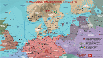
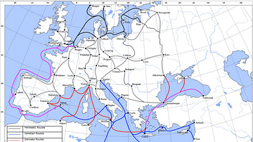
The Hanseatic League - Trade in the North and Baltic Seas c. 1400
A map illustrating the expanse and complexity of the northern Europen trade network of commerce and the powerful association of cities and merchant guilds known as the Hanseatic League (from Old High German - Hanse for “guild,” or “association,”...
Image
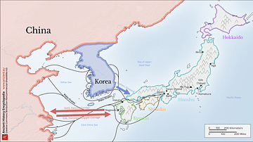
Map of Medieval Japanese Trade & Wako Pirates
Map depicting Medieval Japan and its trade relations with its neighbours, China and Korea. The map shows the major trade goods exchanged between Japan, China, and Korea. Black lines show the approximate routes taken by the Wako Pirates. Each...

Video
History of the Major Trade Routes - Summary on a Map
In this video, let's retrace the evolution of the world’s major trade routes, from the Incense Route until today.
Definition
Portuguese Nagasaki
Nagasaki, on the northwest coast of Japan’s Kyushu Island, was an important Portuguese trading base from c. 1571 to 1639, and the most eastern outpost of the Portuguese empire. The Portuguese presence transformed Nagasaki from a small fishing...

Image
Trans-Saharan Trade Routes
A map indicating the major trans-Saharan trade routes across West Africa c. 1100-1500 CE. The darker yellow areas indicate gold fields.
Image
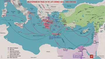
Mediterranean Trade in the Late Bronze Age c. 1400-1200 BCE
A map illustrating the late Bronze Age trade in the eastern Mediterranean seaboard as a region of increasing connectivity between the key players Pharaonic Egypt in the south, the Hittite Empire, Mesopotamia, and the Levant to the east, and...
Image
Late Medieval Land & Maritime Trade Routes
A map showing the late medieval trade routes by land and sea across Europe and Western Asia.
Image
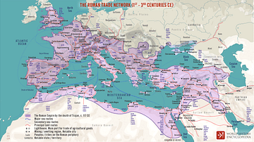
The Roman Trade Network (1st - 3rd centuries CE)
A map illustrating the principal trade routes of overseas and transregional exchange of goods across the Roman Empire between the first and third centuries. The depiction is schematic not only for the completeness of adequate historical knowledge...
Image
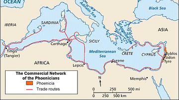
Phoenician Trade Network
Map of Phoenicia and its trade routes.
Image
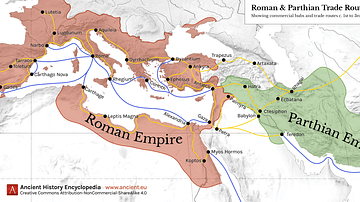
Map of Roman & Parthian Trade Routes
This map shows the Roman-Parthian trade route system, circa between the 1st and the 3rd centuries CE. During this period, the Roman Empire and the Parthian Empire were the two superpowers of the region and the Roman-Parthian trade system...