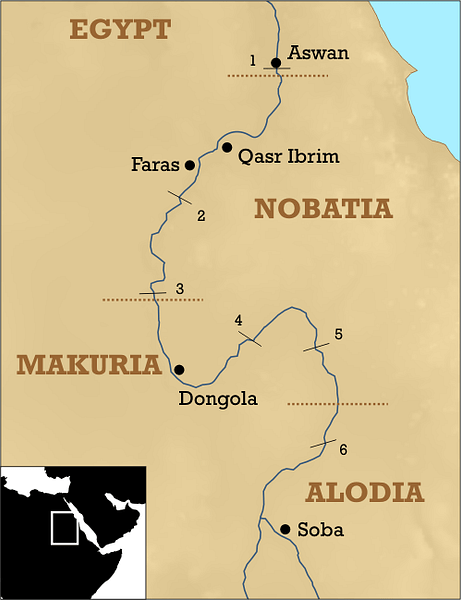
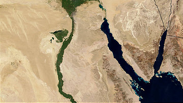
In ancient times, the First Cataract at Aswan marked the southern frontier of Egypt. Beyond lay the land of Nubia, which stretched along the river Nile from the First Cataract southwards for about 250 kilometres (155 mi). This region, known as Lower (northern Egyptian) Nubia, functioned as a buffer zone between the two power centres of Egypt and Kush, the latter extending farther to the south to the Sixth Cataract in modern Sudan.
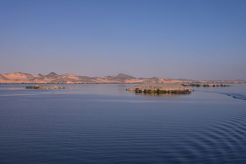
As a result of the construction of the Aswan High Dam in the 1960s, most of Egyptian Nubia is presently beneath the waters of Lake Nasser. Through a massive UNESCO international salvage project, many ancient monuments of Lower Nubia were dismantled and moved to higher ground beyond the reach of the water, including the temples of Ramesses II at Abu Simbel, while others were transferred to foreign countries as gifts in recognition for their collaboration. Today, cruises on the 500-kilometre-long (310 mi) Lake Nasser include stops to a dozen monuments of ancient Nubia rescued by the international community in one of the most dramatic feats of engineering and conservation in the world.
Ancient Nubia
For thousands of years, the Nile has given life to the lands through which it flows. It offered a fertile corridor in an otherwise arid landscape, and Africa's oldest civilisations thrived along the Nile's valleys, using its vast waterways to expand their reach across the ancient world. The region was also a route for trade between sub-Saharan Africa, Nubia and Egypt. Known for its natural resources, Nubia was the gateway through which luxury products like gold, ebony, and ivory travelled from their source to the Mediterranean civilisations.
Control of the Nubian region fluctuated between the Egyptians and the indigenous peoples. During the Middle Kingdom (2040-1782 BCE), Egypt occupied Lower Nubia and extended its authority to the Second Cataract. After a hiatus of some 200 years during the Second Intermediate Period of Egypt, the Egyptians returned and subjugated the country as far south as the Fourth Cataract, with a new administrative centre at Napata during the New Kingdom (c. 1570-1069 BCE). The native population was Egyptianized and introduced to Egyptian religion. Egyptian temples were built, many of them honouring Nubian deities, not usually seen in Egypt.
Under the rule of the Ptolemaic Dynasty and Roman Egypt, Lower Nubia was known as the Dodekaschoinos ("Twelve Cities" in Greek) and formed a buffer zone between the Roman Empire and the Kushite Kingdom of Meroë, which marked the apogee of Nubian civilisation. Christianity was introduced to the region in the 4th century CE and became the dominant religion in Egypt and Nubia. Many temples were abandoned, destroyed, or converted into chapels.
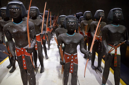
The early Egyptians called the land of Ancient Nubia "Ta-Seti", meaning "Land of the bow", as the Nubians were known for their archery skills, while its modern name is thought to derive from nbw, the ancient word for gold. Another theory claims that Nubia derives from the Noba people who settled there in the 4th century CE following the collapse of the Meroitic kingdom.
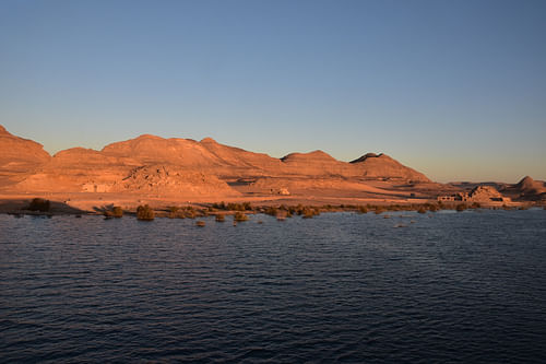
Today, much of Egyptian Nubia has become a vast lake. With the construction of the Aswan Dams and the formation of Lake Nasser, the ancestral home of the Nubian people was entirely submerged, and the rising water threatened the historical sites. Lake Nasser (known as Lake Nubia in Sudan) is the world's largest artificial lake, stretching 500 kilometres (310 mi) down the valley as far south as the Dal Cataract in northern Sudan. Under a colossal international project coordinated by UNESCO, the ancient monuments of Nubia were moved to higher ground where tourists can easily visit them today by boat. Others were sent to foreign museums in Madrid (Debod), New York (Dendur), Leiden (Taffeh) and Turin (Ellesyia).
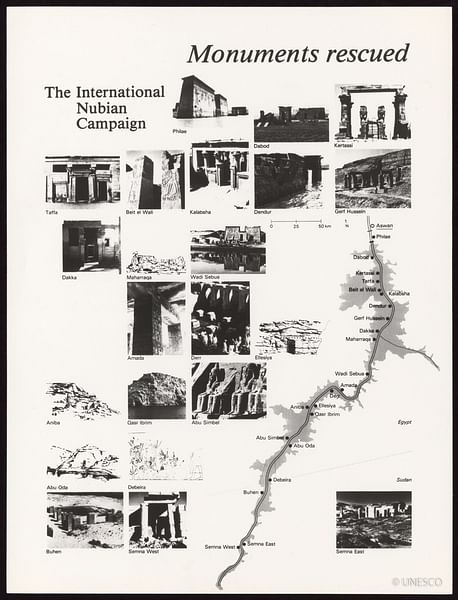
Having enjoyed a fantastic Nile cruise from Luxor to Aswan in February 2020, just before the COVID-19 pandemic struck, I returned to Egypt as soon as its international borders reopened for tourism to sail farther south to Abu Simbel. I went on a four-day cruise to visit the otherwise inaccessible monuments of Ancient Nubia relocated along the banks of Lake Nasser. The shoreline of Lake Nasser has some of the country's most diverse and dramatic desert landscapes. It is abundant in wildlife, too. Many species have settled along the shores of Lake Nasser, and it is an important staging point for migrating birds during the overwintering period. The waters of Lake Nasser are also the only place in Egypt where one can still see the infamous Nile crocodiles.
Our cruise ship sailed for four nights, from Aswan to Abu Simbel. On the way, we explored the scattered and lesser-known Nubian temples, including Kalabsha, Wadi es-Sebua, Amada, and Qasr Ibrim. Some of them are located in splendid isolation in the middle of the Sahara desert.
New Kalabsha
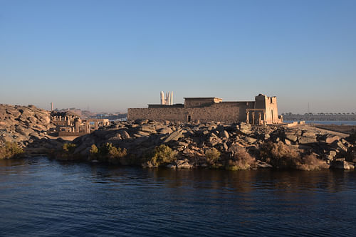
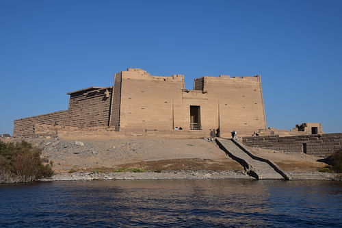
The first temple complex we visited once the boat began to sail was New Kalabsha, a promontory located just above the High Dam a few kilometres south of Aswan. It houses several temples and other structures that have been relocated to their current position from the ancient city of Talmis (later known as Kalabsha) and other sites in Lower Nubia. The site can also be accessed by taxi from Aswan, then by motorboat to the island.
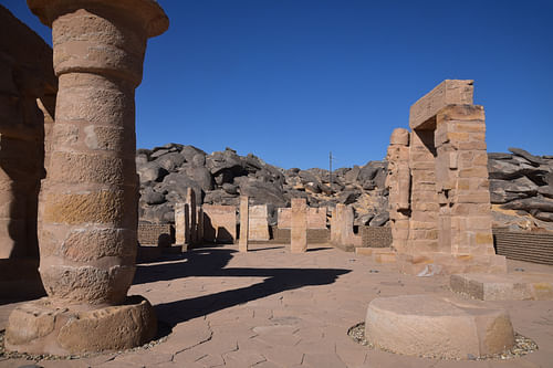
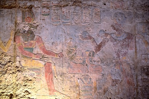
The most significant monument at New Kalabsha is the Temple of Mandulis (also known as the Temple of Kalabsha), the largest free-standing temple of Egyptian Nubia. It originally stood 50 kilometres (31 mi) south on the west bank of the Nile at ancient Talmis, which is now submerged. The temple was dismantled, cut into 13,000 blocks and reassembled here in 1970 by a West German-financed operation. The temple was built as a tribute to the Nubian sun god Mandulis around 30 BCE, presumably on the site of an earlier temple of the New Kingdom of Egypt. The decoration of the temple's walls was never completed but contained brightly painted scenes of Mandulis with Osiris, Isis, and Horus. The Roman emperor Augustus (r. 27 BCE to 14 CE) appears as a pharaoh on the back wall of the temple's sanctuary, making an offering to Horus and Isis.
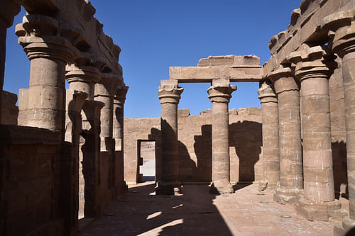
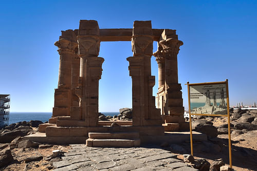
Another monument dated to the Roman period at New Kalabsha is the small Kiosk of Qertassi. The structure is made of sandstone and is composed of a court surrounded by columns, resembling the Kiosk of Trajan on Philae. Although incomplete and uninscribed, its lotus-headed columns and Hathor pillars give the monument an elegant and picturesque appearance. The Egyptian Antiquities Service dismantled the kiosk and moved it to the site of New Kalabsha during the salvage campaign.
The New Kalabsha promontory also houses two rock-cut temples, the temple of Gerf Hussein and the Chapel of Dedwen. Gerf Hussein (originally known as Per Ptah, the "House of Ptah") was built by Setau, Viceroy of Kush, during the reign of Ramesses II (r. 1279-1213 BCE). The temple was dedicated to Ptah and Hathor and the deified Ramesses II. It was originally located at a site some 90 kilometres (56 mi) south of Aswan. The interior of the temple of Gerf Hussein could not be rescued from the waters of the Nile because of its poor condition and is now underwater. The Chapel of Dedwen contains reliefs of an unknown pharaoh offering to the Nubian god Dedwen and the victory stela of Seti I.
Finally, another monument relocated to New Kalabsha was the Temple of Beit el-Wali, the first and northernmost in a series of eight known temples built by Ramesses II in this region over five decades. The inner part of the temple contains brightly painted reliefs depicting Ramesses II in a battle against his Nubian and Libyan enemies and making offerings to the gods.
New Wadi es-Sebua
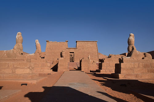
Having sailed half the length of Lake Nasser, we reached New Wadi es-Sebua, a temple complex area in the middle of the Sahara desert. It contains three ancient Nubian temples, which were moved there as part of the large rescue effort led by UNESCO between 1961 and 1965; Wadi es-Sebua, the Temple of Maharraqa and the Temple of Dakka. A one-kilometre-long (0.6 mi) track across the desert joins them, allowing visitors to enjoy the beautiful Sahara landscape all around. Wadi es-Sebua means "Valley of the Lions" and refers to the sphinx-lined avenue leading to the temple of that name.
The temple of Wadi es-Sebua, originally situated 4 kilometres (2.5 mi) west of its present location, is the most beautiful monument in Lower Nubia. It was built during the reign of Ramesses II by his viceroy of Kush, Setau, and was dedicated to Amun-Ra and Ra-Harakhty. The structure is partly rock-cut and partly free-standing. Two sets of three sphinxes wearing double crowns stand in the first court of the temple, with images of bound figures representing Nubian and Asiatic prisoners on their bases. Four falcon-headed sphinxes stand the second court, with a figurine of Ramesses II standing between their front paws.

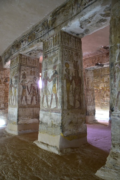
The peristyle court of the temple is filled with reliefs displaying processions of Ramesses II's sons and daughters on both walls and pillars with figures of Ramesses himself with both arms crossed and wearing a shendyt. The inner sanctuary, carved into the bedrock, was converted into a Coptic church in the 5th century CE. The ancient reliefs were then plastered over but had the unintended effect of protecting them.
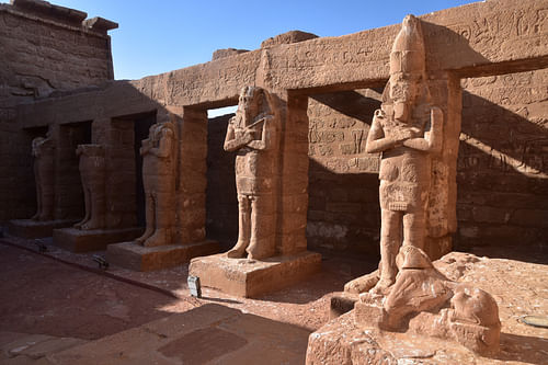
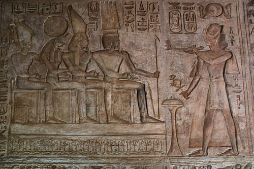
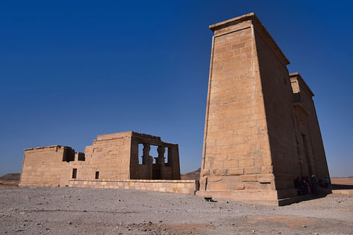
From Wadi es-Sebua, we walked about 20 minutes across the desert to the Temple of Dakka that once stood 40 kilometres (25 mi) upstream. It was first begun in the 3rd century BCE by the Kushite King of Meroë Arkamani (or Ergamenes II) in collaboration with Ptolemy IV (r. 221-204 BCE), who dedicated it to the god Thoth. Its construction continued in the reigns of later Ptolemies and Roman emperors Augustus and Tiberius (r. 14-37 CE), who enlarged the structure by constructing a massive 12-metre-high (40 ft) pylon, today its most striking feature. The antechamber contains many bas-reliefs showing a Ptolemaic pharaoh making traditional offerings to an array of gods.
A few metres away from the Temple of Dakka lies the Roman-built Egyptian Temple of Maharraqa, a tiny and unfinished temple dedicated to Serapis and Isis. Its elegant inner court is surrounded on three sides by columns and features an architectural curiosity, the only spiral staircase known in an ancient Egyptian building.
New Amada
We then continued to sail southward past some of the most beautiful parts of Lake Nasser to the New Amada site, which also contains three ancient Nubian monuments spared from the rising waters of Lake Nasser. It is the new location of the oldest temple ever found in Nubia and the only rock-cut temple built on the right bank of the Nile. The site also houses the Tomb of Pennut, one of the rarest rock-cut tombs belonging to the Kingdom of Kush.
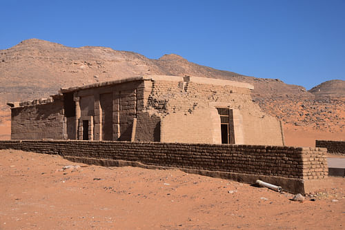
The Temple of Amada is a small sandstone temple built during the co-regency of Thutmose III (r. 1458-1425 BCE) and Amenhotep II (1427-1401 BCE), with later additions by Thutmose IV (r. c. 1401-1391 BCE) and restorations by several kings of the Nineteenth Dynasty (1292-1189 BCE). Its exterior looks unimposing, but the innermost section of the temple has fine reliefs and several important historical inscriptions. The temple was relocated to a higher position, some 2.6 kilometres (1.6 mi) inland. It is the oldest temple ever found in Nubia.
The sandstone temple was dedicated to Amun-Ra and Ra-Harakhte. The reliefs, some with well-preserved colours, depict Thutmose III and Amenhotep II as equal rulers making offerings to various gods and participating in different pharaonic rituals. The historical inscriptions relate to the battles undertaken by the two pharaohs. One is dated to the third year of Amenhotep II and describes a military campaign into Asia. The other depicts a Libyan invasion of Egypt in the fourth year of Mernepta (r. 1213-1203 BCE). The temple was converted into a church in the early medieval period.
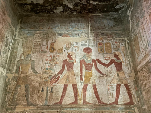
A few metres away from the Temple of Amada stands the Temple of Derr, a rock-cut temple built by Ramesses II and dedicated to Ra-Harakhte, Amun-Ra, and Ptah. The temple contains two hypostyle halls and three chambers, the central one having cult statues of the three gods and the deified Ramesses II. The temple features some unusually bright painted reliefs with vivid colours. The walls show scenes of the king engaging in purification rituals with various deities, while the painted ceiling depicts vultures.
The Temple of Derr was the only temple in Nubia situated on the east bank of the Nile. In 1964, UNESCO moved the temple 2.6 kilometres to the west bank.
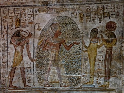
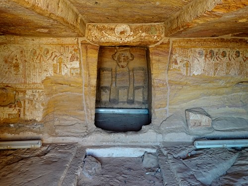
The third and last structure at New Amada is the Tomb of Pennut, the viceroy of Kush under Ramesses VI (r. 1143-1136 BCE). It consists of an antechamber and a niche with the remains of three destroyed statues. The chamber has scenes of Pennut offering to the gods and others depicting mourners.
Qasr Ibrim
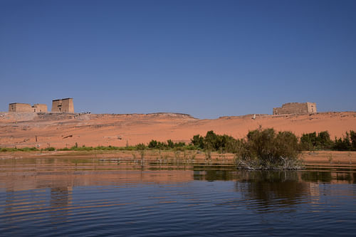
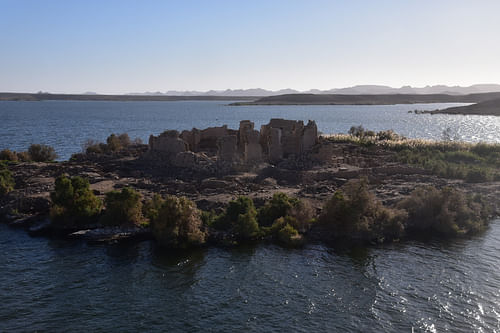
Our last stop on the cruise before reaching Abu Simbel was at the fortress of Qasr Ibrim, the only ancient Nubian site in Egypt to have remained in situ. However, we were only able to gaze upon it from the comforts of our boat, as it is no longer accessible to tourists.
Before the construction of the High Dam and the creation of Lake Nasser, Qasr Ibrim stood on a clifftop some 60 metres (200 ft) above the river. Throughout its long history, ranging from as early as 1000 BCE to 1813 CE, it guarded over a thriving city and controlled the traffic on the river and routes through the eastern desert. Qasr Ibrim became a border fortress under Augustus and played a key role during the Romans' campaign against the Kingdom of Kush at Meroë.
Abu Simbel
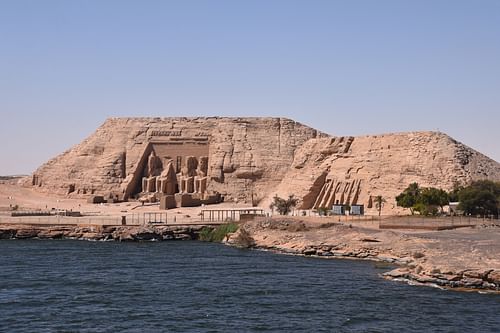
The slow approach by ship to Abu Simbel was nothing less than spectacular. As we came closer, the temples were slowly revealing themselves to us in all their imposing beauty. Most visitors take the 290-kilometre (180 mi) bus ride between Aswan and Abu Simbel across the desert or arrive at the specially-built airport, but they approach Abu Simbel from behind. Onboard our fine vessel, we were lucky to get a full-frontal view of the two temples from the waters that once threatened their destruction.
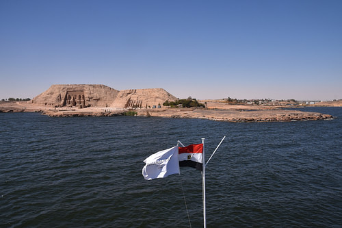
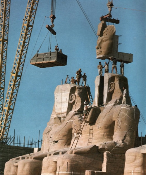
The prospect of losing both temples of Abu Simbel to Lake Nasser impelled UNESCO to organise the salvage of Nubian monuments in the 1960s. The international rescue operation at Abu Simbel was a massive undertaking carried out between 1964 and 1968. The entire site was carefully cut into 1,030 large blocks, dismantled, lifted and reassembled at a new location about 200 metres (656 ft) further inland and 65 metres (213 ft) higher up. Abu Simbel was reassembled on an artificial hill to recreate its former setting. The whole operation cost over 40 million US dollars.
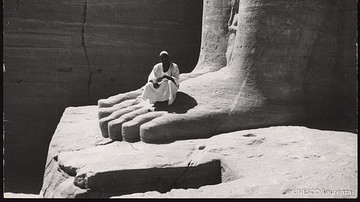
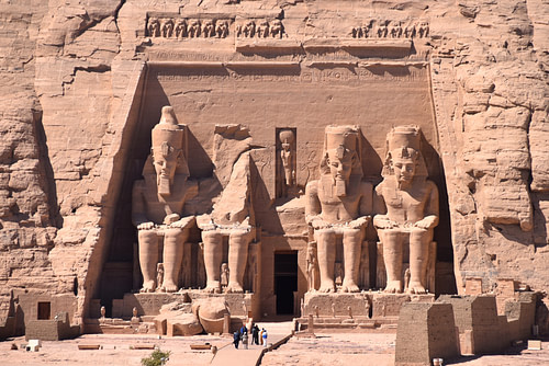
The Great Temple of Ramesses II and the Small Temple of his wife Nefertari, which together make up the temples of Abu Simbel, are among the most famous and spectacular monuments in Egypt. Carved out of the hillside, the Great Temple stands 30 metres (98 ft) high and 35 metres (115 ft) long, with four enthroned colossi of Ramesses II flanking the entrance, two on either side of a rectangular door that leads onto the inner shrine. One colossus lost its upper half following an earthquake in 27 BCE. Beneath these giant figures are smaller statues depicting the king's family members and various protecting gods. Above the central doorway is a niche figure of Ra-Horakhty, and surmounting the Great Temple façade is a frieze of 22 baboons.
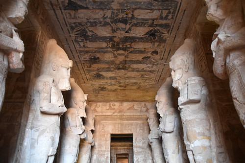
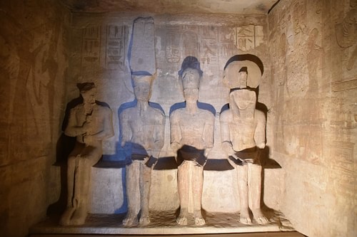
The entrance door of the Temple of Ramesses II leads to a hypostyle hall supported by eight massive pillars depicting Ramesses as Osiris. Beneath a ceiling painted with vultures, the walls are carved with low-reliefs depicting scenes from Ramesses' various military campaigns, focusing on the Battle of Kadesh. Next to the hypostyle hall are eight small chambers that were probably used as storerooms. A second hall lined with four colossal pillars with offering scenes leads to a vestibule connected to a sanctuary where statues of three gods are represented with Ramesses II. The four cult statues are touched by the sun's rays twice a year, at dawn on 22 February and 22 October.
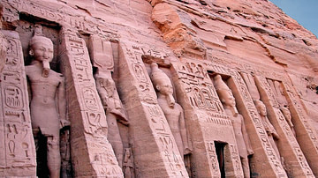
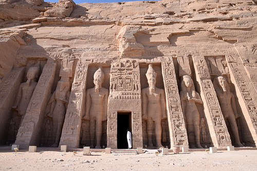
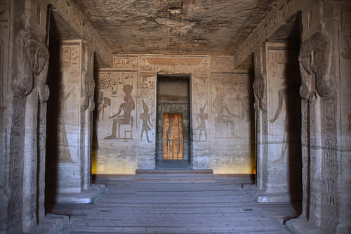
The smaller rock-cut temple, dedicated to Queen Nefertari identified here with the goddess Hathor, consists of three rooms: a hall with Hathor-headed pillars, a vestibule and a sanctuary, with smaller rooms. On the façade, emerging from the rock, are six colossal standing figures representing Ramesses II and Nefertari. Alongside each colossus are small figures in relief depicting the children of the royal couple.
Cruising through the desert on Lake Nasser is a unique and fantastic way to experience and absorb both modern and ancient Egypt. The chance to admire Abu Simbel and the other remote sites from the waters of the Nile should satisfy all the history enthusiasts in search of a relaxing and beautiful cruise.

