Search Maps
Latest Maps

Image
Map of the Mughal Empire at Its Greatest Extent, c. 1707 - Expansion, provinces, and contested frontiers
The Mughal Empire (1526–1857) emerged from the military and political...

Image
Map of Timur’s Empire and Campaigns, 1370–1405 - The rise and the expansion of Tamerlane across Eurasia
The Timurid Empire under Timur (reign 1370–1405) emerged from the fragmented...

Image
Map of Europe on the Eve of World War I, June 1914 - Alliances, Empires, Borders, and Military Power
Between German unification (1871) and the outbreak of the First World...

Image
Map of the Bulgarian Empire under Tsar Samuil - Campaigns against Byzantium and the Struggle for the Balkans
The rise and reign of Tsar Samuil of Bulgaria (effective rule c. 976–997...
Interactive Maps
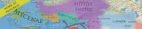
Mapper: Atlas for Time Travellers

Watch empires rise and fall, follow migrations, and navigate history one year at a time. Browse political boundaries from 2400 BCE through 263 BCE at any level of magnification. Every border, every empire, rendered from primary historical data.