
Browse Content
Image
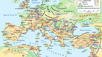
Map of the Roman Empire in 125 CE
A map of the Roman Empire and Europe in 125 CE, at the time of...

Image
Map of the Trojan War States, c. 1200 BCE
The Bronze Age collapse at the end of the 13th century BCE saw...
Image
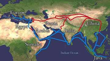
Map of the Silk Road Routes
This map indicates trading routes used around the 1st century CE...
Image
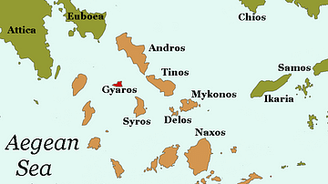
Map of Gyaros
A map of Gyaros, a barren island in the Cyclades. Gyaros' remote...
Image
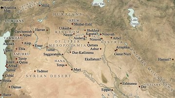
Map of Mesopotamia, 2000-1600 BCE
A general map of Mesopotamia and its neighbouring territories which...

Image
Map of the Expansion of Macedon
A map showing the expansion of Macedon, around the time of the...