
Browse Content
Image
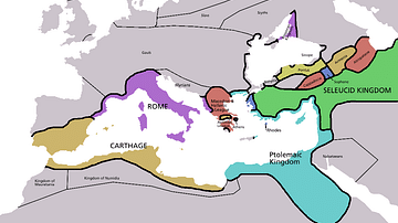
Map of Europe in 220 BC
Approximate borders in Europe around 220 BC. Based on the Pengiun...
Image
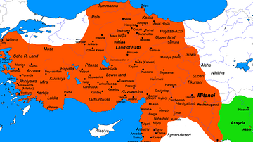
Map of the Hittite Empire (c. 1300 BC)
Map of the Hittite Empire at its greatest extent under Suppiluliuma...
Image
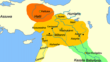
Map of Mesopotamia, c. 1400 BCE
This is a map of Mesopotamia showing the dominant kingdoms of Egypt...
Image
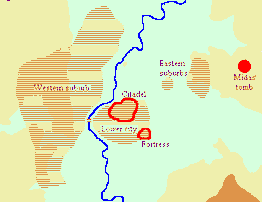
Map of Gordium
A map depicting the approximate layout of the Phrygian city of...
Image
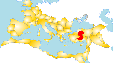
Map of the Roman Province of Galatia
A map showing the position of the province of Galatia within the...
Image
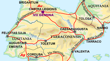
Map of the Iberian Penninsula in 125 AD
A map showing Iberian peninsula in 125 AD including important roads...