
Browse Content

Image
Map of Byzantine Constantinople
Topographical map of Constantinople during the Byzantine period...
Image
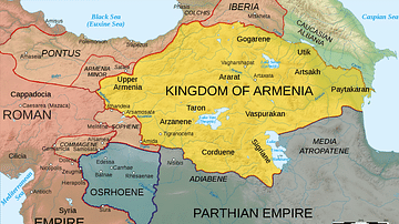
Map of Armenia, 50 CE
Map of Armenia and the Roman client states in eastern Asia Minor...
Image
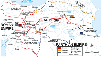
Map Roman-Parthian War, 58-60 CE
Map of the troop movements during the first two years of the Roman-Parthian...
Image
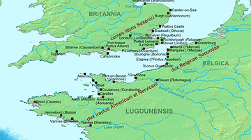
Map of the Saxon Shore, c. 380 CE
The Late Roman fortifications of the "Saxon Shore" (litus Saxonicum...
Image
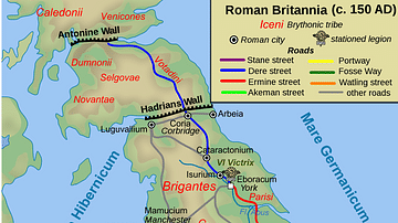
Map of Roman Britain, 150 AD
Map of Roman Britain ca. 150 AD, showing the main Roman roads...
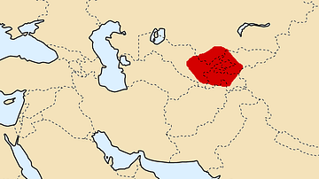
Image
Map of Sogdiana, ca. 300 BCE
Map of Sogdiana ca. 300 BCE. (Alternate names: Sughd, Sugdiane...