
Browse Content

Image
Map of Mutapa
A 1635 CE map of southern Africa by Willem Janszoon Blaeu. It shows...

Image
Map of Kingdom of Axum
A map indicating the area controlled by the African kingdom of...
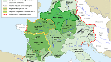
Image
Map of Francia
Map of Francia from 481 to 814 CE.

Image
Map of Nok Culture Territory
A map indicating the approximate territory inhabited by the people...
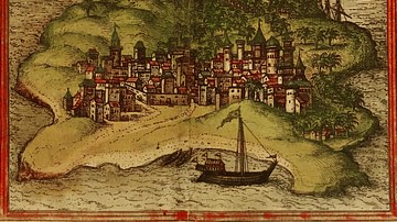
Image
Kilwa Map Illustration
An illustration of the trading city-state of Kilwa on the Swahili...

Image
Swahili Coast Map
A map of the east coast of Africa showing, amongst others, the...