
Browse Content
Image
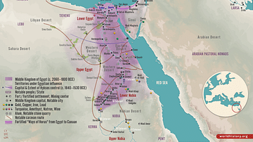
Middle Kingdom of Egypt, c. 2000 BCE
This map illustrates the Middle Kingdom of Egypt (c. 2055–1650...
Image
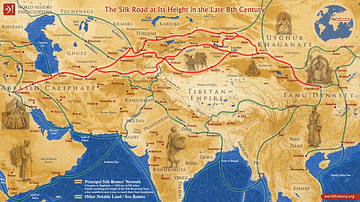
The Silk Road at Its Height in the Late 8th Century
This map illustrates the Silk Road in the late 8th century, a vital...
Image
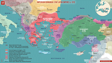
Division of the Byzantine Empire, 1204 CE.
This map illustrates the rise of the Latin Empire (Imperium Romaniae...
Image
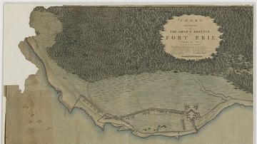
Siege and Defence of Fort Erie
Chart Illustrative of the Siege & Defence of Fort Erie. Campaign...
Image
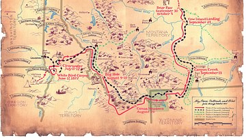
Flight of the Nez Perce and Key Battle Sites of 1877
Map of the flight of the Nez Perce toward Canada in 1877 and key...
Image
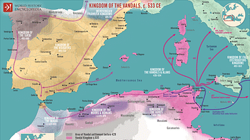
The Kingdom of the Vandals (435–534 CE)
This map illustrates the history of the Kingdom of the Vandals...