
Browse Content
Image
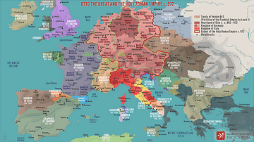
Otto the Great and the Holy Roman Empire c. 972
A map illustrating the emergence of the Holy Roman Empire (after...
Image
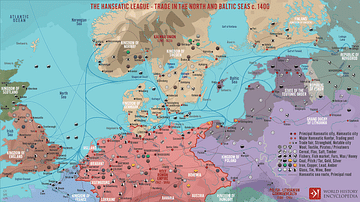
The Hanseatic League - Trade in the North and Baltic Seas c. 1400
A map illustrating the expanse and complexity of the northern Europen...
Image
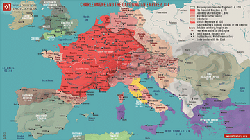
Charlemagne and the Carolingian Empire c. 814
A map illustrating the rise and expansion by conquest of the Frankish...
Image
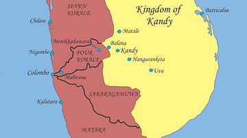
Sri Lanka, Early 17th Century
Political situation in Sri Lanka, early 17th century.
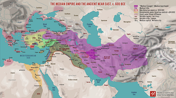
Image
The Median Empire and the Ancient Near East, c. 600 BCE
A map illustrating the rise and expansion of the Median Empire...
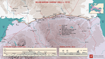
Image
Vallum Hadriani (Hadrian’s wall), c. 122 CE
A map illustrating the span, structure, and context of the 73 miles...