
Browse Content
Image
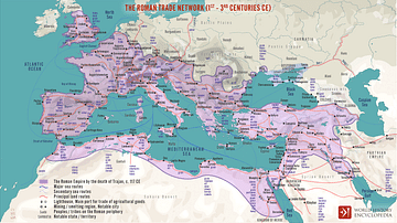
The Roman Trade Network (1st - 3rd centuries CE)
A map illustrating the principal trade routes of overseas and transregional...
Image
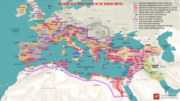
The Growth of Christianity in the Roman Empire
A map illustrating the rise and spread of Christianity from a small...
Image
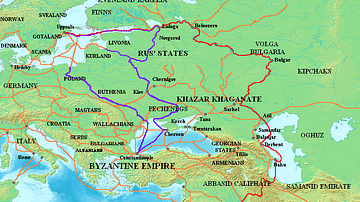
Varangian Trade Routes
Map showing Varangian trade routes. Red: Volga trade route Purple...
Image
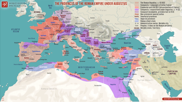
The Provinces of the Roman Empire under Augustus
A map illustrating the expansion of the Roman Republic during the...
Image
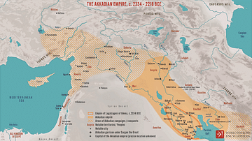
The Akkadian Empire, c. 2334 - 2218 BCE
A map illustrating the rise of the Akkadian Empire from its origins...
Image
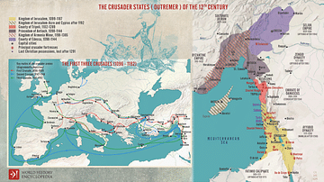
The First Three Crusades and the 12th-Century Latin East (Outremer)
Maps illustrating the trajectory of a series of early military...