
Browse Content
Image
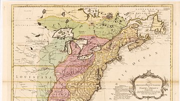
English & French Colonies in North America, 1758 CE
Map of English and French colonies in North America c. 1758 CE...
Image
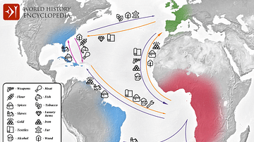
Transatlantic Triangular Trade Map
Map showing the flow of goods and enslaved people across the Atlantic...
Image
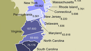
Enslaved Population of the 13 Colonies
Map of the 13 Colonies showing the estimated number of enslaved...
Image
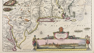
Map of New Netherland
Map of the New Netherland colonies c. 1696 and 1701 CE, by Justus...
Image
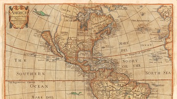
Map of the Americas, 1666 CE
"Americæ descriptio nova", a map of the Americas in 1666 CE. Made...
Image
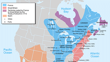
Map of New France, 1750 CE
A map of New France c. 1750 CE within the context of European colonies...