
Browse Content
Image
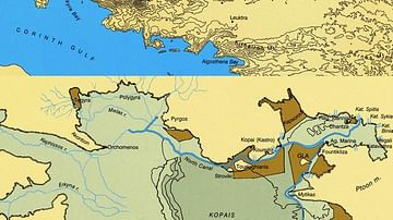
Maps of Boeotia, Lake Copais, Gla & Orchomenos
Maps of Boeotia (top) and Lake Copais (bottom). Photo © Antonia...
Image
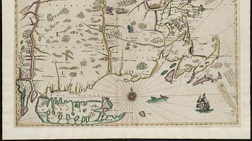
New England, 1665 CE
Map of New England printed by John Seller John in 1675 CE, based...
Image
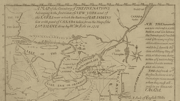
Map of the Five Nations, 1730 CE
Map of the Five Nations, 1730 CE. Darlington map collection, Archives...
Image
Map of New England
Map of New England by Captain John Smith Printed by Geor. Low...
Image
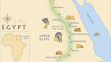
Map of Ancient Egypt
Map of ancient Egypt, showing the major cities and archaeological...
Image
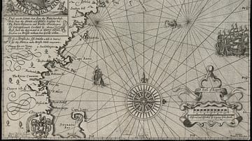
Map of New France, 1612 CE
Map of New France 1612 CE by Samuel de Champlain (1567?-1635 CE...