
Browse Content
Image
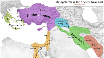
Map of Mesopotamia and the Ancient Near East, c. 1300 BCE
Map of Mesopotamia and the Ancient Near East c. 1300 BCE, showing...
Image
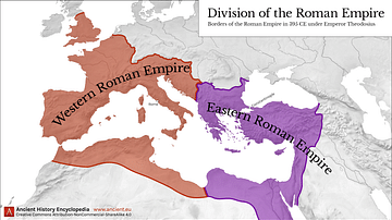
Western & Eastern Roman Empire, 395 CE
This map shows the division of the Roman Empire into the Western...
Image
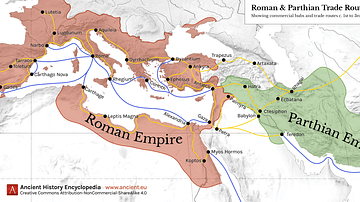
Map of Roman & Parthian Trade Routes
This map shows the Roman-Parthian trade route system, circa between...
Image
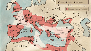
Trade in the Roman Empire Map (c. 200 CE)
This map shows the major sources of trade goods in the Roman Empire...
Image
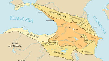
Georgia under Queen Tamar
Georgian empire with tributaries.

Image
Spread of Christianity Map (up to 600 CE)
Map showing the spread of Christianity, showing both strongly Christianized...