
Browse Content
Image
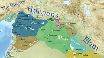
Ancient Syro-Mesopotamia ca. 1764 BCE
This map shows the political situation in Syro-Mesopotamia c. 1764...
Image
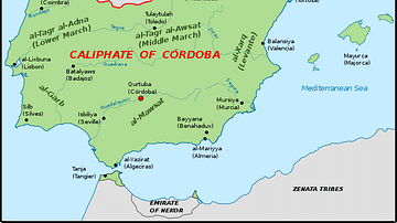
The Iberian Peninsula, c. 1000 CE
A map of the Iberian peninsula c. 1000 CE showing the divide between...
Image
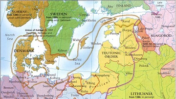
Baltic States 1100-1400 CE
This map illustrates the Baltic states in the period 1100-1400...
Image
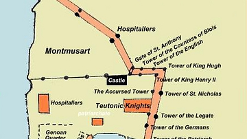
Plan of Acre, 1291 CE
A plan of the city of Acre at the time of the 1291 CE siege by...
Image
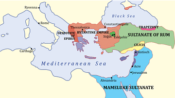
The Levant, 1263 CE
A map showing the various states of the Levant c. 1263 CE. Light...
Image
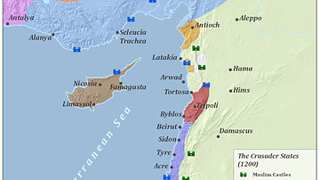
Crusader States 1200 CE
This map shows the crusader states c. 1200 CE.