
Browse Content
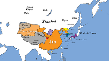
Image
East Asia circa 300 CE
This map shows all major civilizations of East Asia at the beginning...
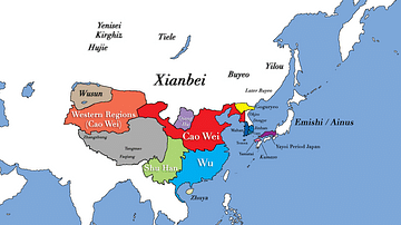
Image
Three Kingdoms Period of China and the Rise of Xianbei in the year 229 CE
This map depicts the boundaries of all major civilizations in East...
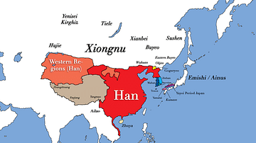
Image
East Asia in the year 1 CE
This map shows the boundaries of all major civilizations in East...
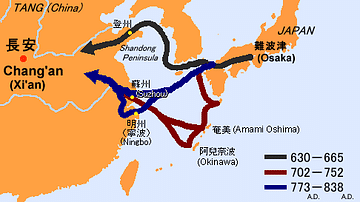
Image
Sea Routes from Ancient Japan to China
A map illustrating possible sea routes used for political and cultural...
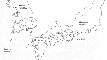
Image
The Korean Peninsula and the Japanese Archipelago, 3rd-6th century CE
Map of Pen/Insular states and potential centres in the 3rd–6th...
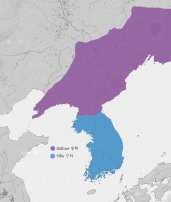
Image
Unified Silla & Balhae Kingdoms
A map showing the territory of the Unified Silla Kingdom (668-...