
Image Gallery

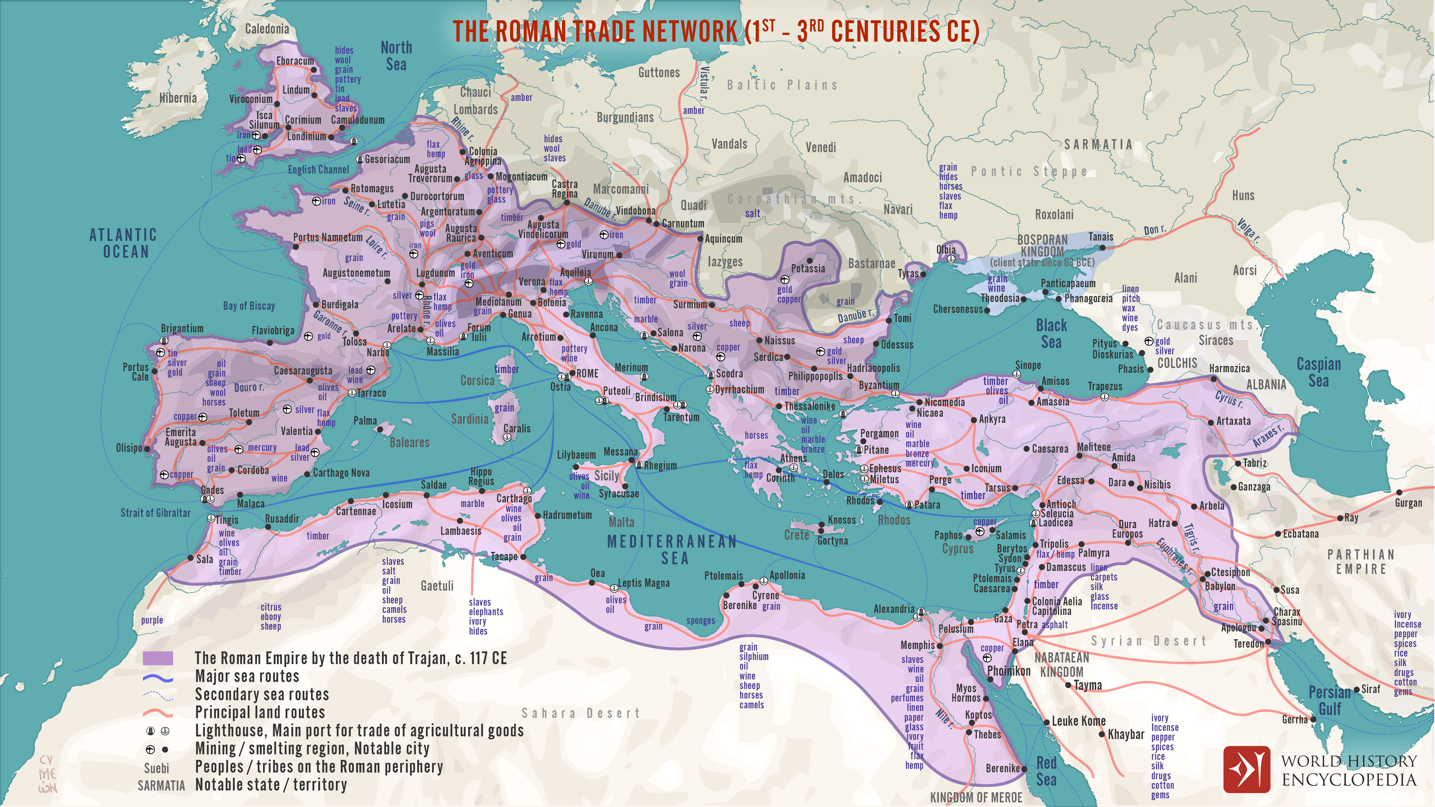
The Roman Trade Network (1st - 3rd centuries CE)

A map illustrating the principal trade routes of overseas and transregional exchange of goods across the Roman Empire between the first and third centuries. The depiction is schematic not only for the completeness of adequate historical knowledge of the exact ancient shipping channels but also for the alternating winds direction in the Mediterranean, which would make the outward and return paths different. The overland routes would have followed multitudes of roads and navigable waterways, which varied in diversity and complexity from province to province.