
Image Gallery

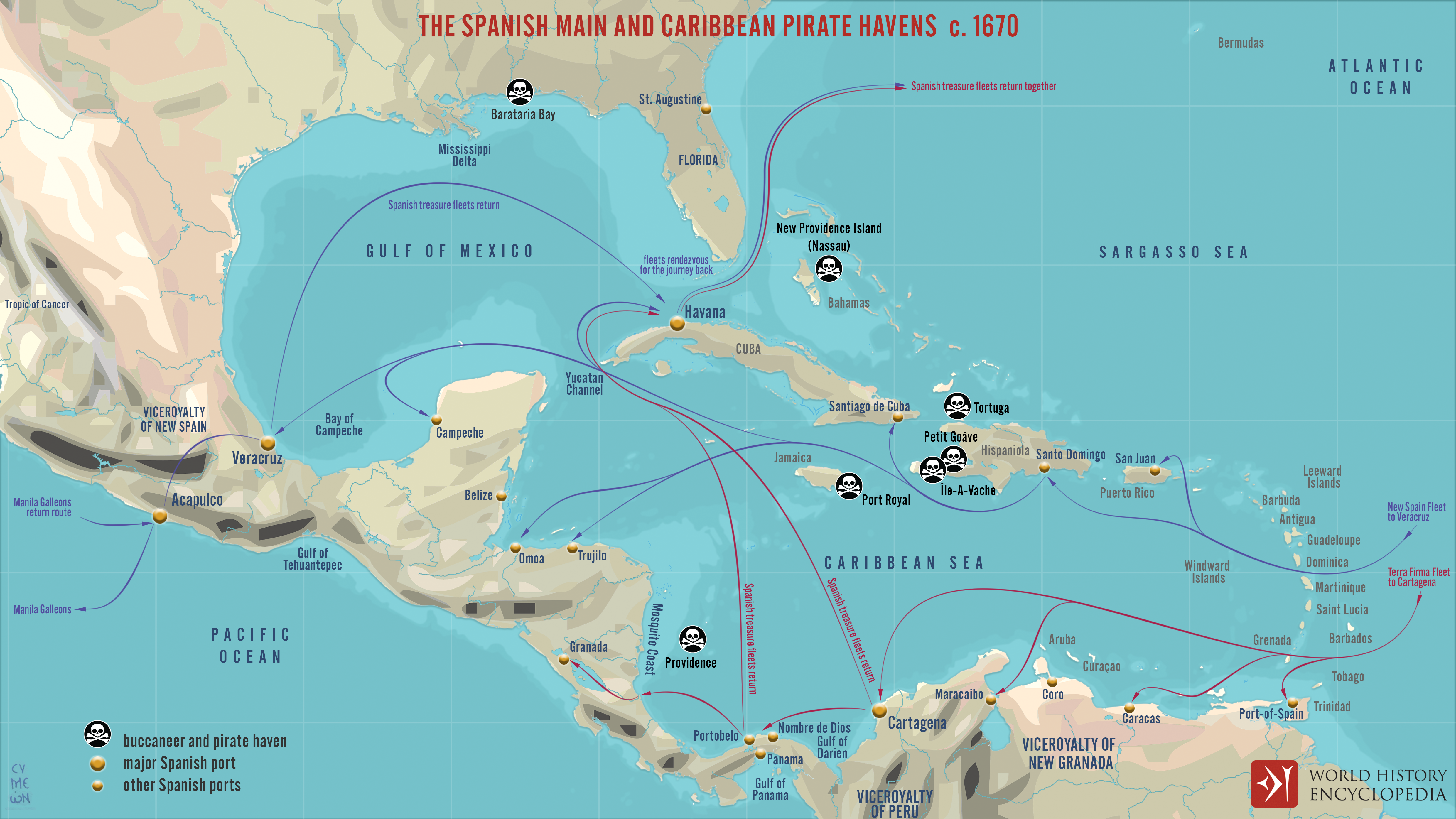
The Spanish Main and Caribbean Pirate Havens c. 1670

A map illustrating the routes of the Treasure Fleet (the New Spain and the Terra Firma Fleet) alongside the Spanish Main (the parts of the Spanish Empire on the mainland of the Americas with coastlines on the Caribbean Sea and the Gulf of Mexico) and the islands in the Caribbean (Spanish West Indies). It also depicts the most notorious havens of the buccaneers and pirates that prayed on merchant shipping and the flow of Spanish treasure from the region.