
Image Gallery

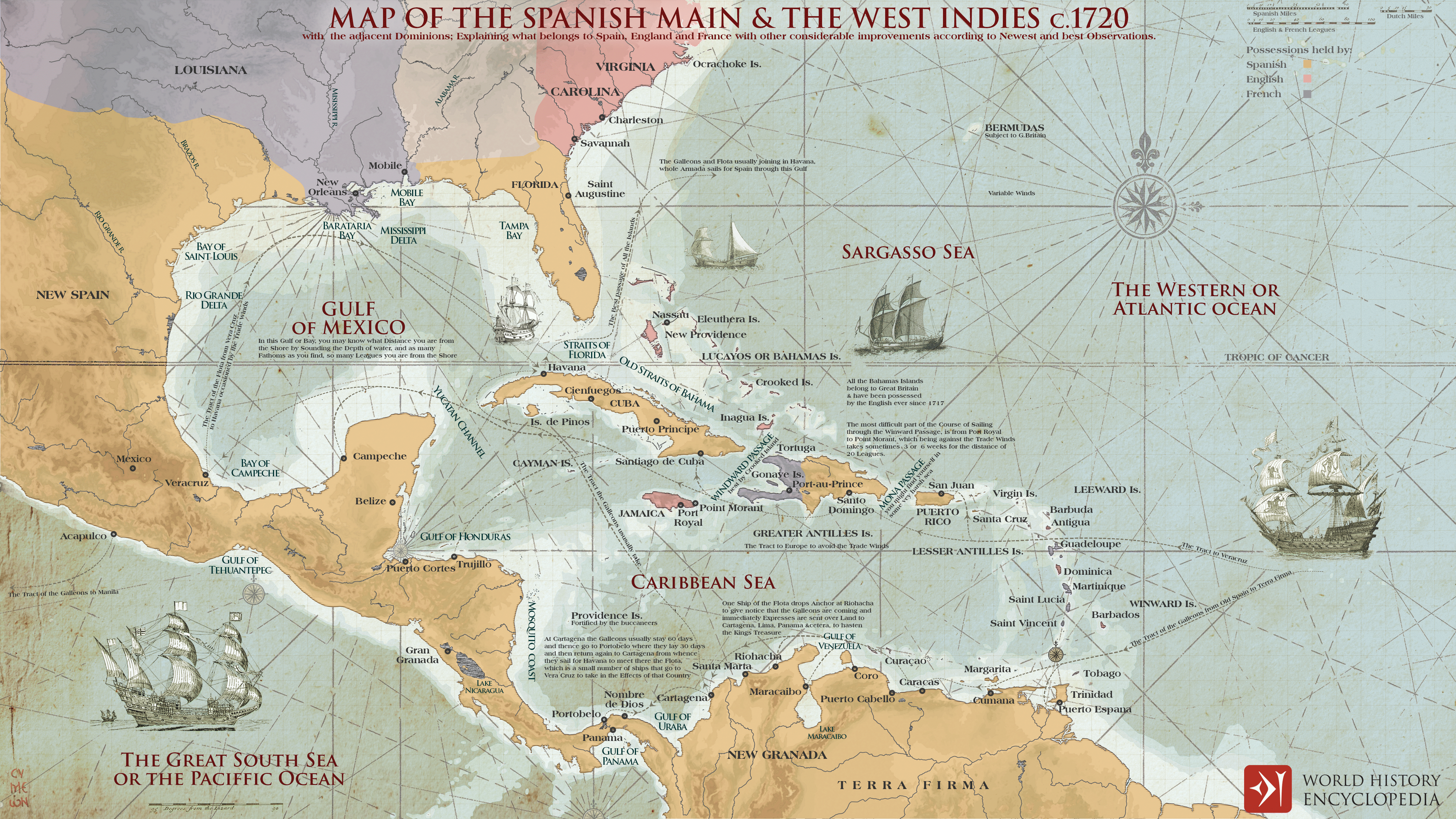
The Spanish Main & the West Indies c.1720

A map illustrating the changing balance of colonial power among the Spanish, English, and French Empires in the 1700s along the coastlines of the Americas, specifically in the Caribbean Sea and the Gulf of Mexico. This region, referred to as the Spanish Main and the West Indies, witnessed significant shifts in dominance. Additionally, the map depicts the trade patterns and routes followed by the Spanish Treasure Fleets, offering insights into the flow of commerce during that era.