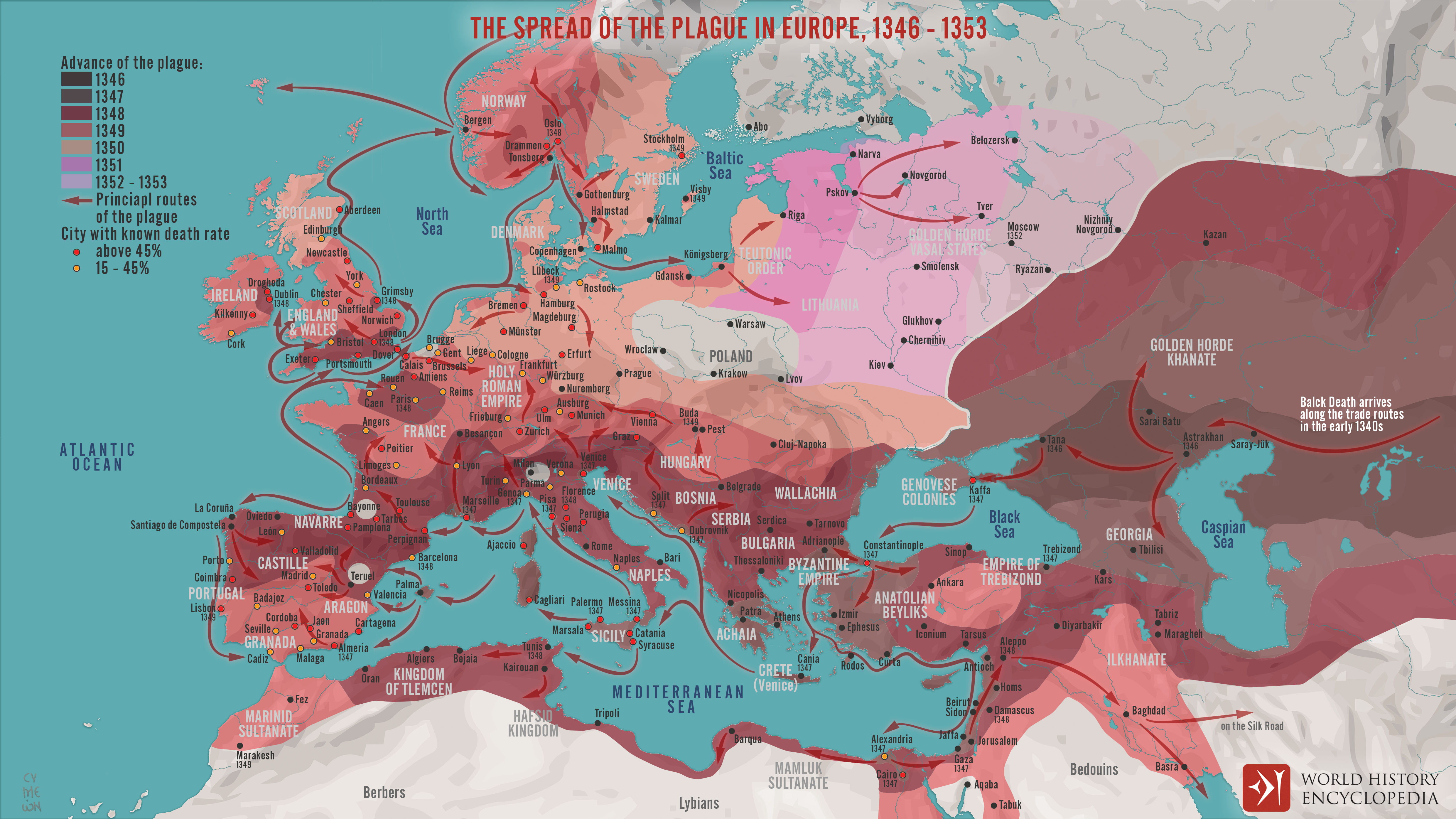
This map illustrates the spread of the 14th-century plague pandemic, the “Black Death,” which swept across Europe and the Middle East between 1346 and 1353. Originating in Central Asia, it traveled on merchant vessels carrying grain and furs from the Italian Black Sea colonies of Kaffa and Tana, moving rapidly along dense and interwoven sea and land trade routes to reach nearly every corner of the continent in just a few years.
Carried by fleas on black rats, the causative bacterium Yersinia pestis spread with devastating speed, striking ports like Messina in 1347, Paris in 1348, and London in 1349. This was the second great pandemic after the 541–549 outbreak during the reign of Emperor Justinian. Mortality rates varied, but the Black Death is estimated to have killed 25 million people, about a third of Europe’s population, bringing lasting social, economic, and cultural upheaval, from acute labor shortages to challenges to religious and political authority.
Uploaded by Simeon Netchev, published on 22 March 2020. The copyright holder has published this content under the following license: Creative Commons Attribution-NonCommercial-NoDerivs. This licence only allows others to download this content and share it with others as long as the author is credited, but they can't change the content in any way or use it commercially. When republishing on the web a hyperlink back to the original content source URL must be included. Please note that content linked from this page may have different licensing terms.


