Search
Search Results

Image
The Columbian Exchange in the 15th century
An infographic illustrating the exchange of diseases, animals, plants, populations, and technology between the Americas, Africa, and Eurasia in the wake of Christopher Columbus' 1492 voyage across the Atlantic, known as the "Columbian Exchange"...

Image
Map of Japan in the 16th Century CE
A map of Japan during the Azuchi-Momoyama period (1568-1600 CE).

Image
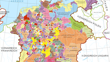
Holy Roman Empire in the 13th century CE
A map in German of central Europe during the time of the Hohenstaufen Emperors, primarily showing the territories of the Holy Roman Empire and the Kingdom of Sicily. The map is a vectorised version of this map from Professor G. Droysens...

Image
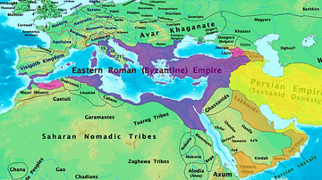
Byzantine & Persian Empires in the 7th Century
A map showing the extent of the Byzantine Empire and the Sasanian Empire in the 7th century.

Image
Map of the Hellenic Leagues and Hegemonies, 4th century BCE
The political landscape of the Hellenic world shifted dramatically in the aftermath of the Peloponnesian War (431–404 BCE), a conflict that ended with Sparta’s victory but left the Greek city-states militarily exhausted and politically fragmented...

Image
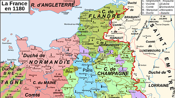
Map of 12th-Century France
A map showing the various counties and duchies of France at the end of the 12th century.

Image
16th Century CE Kitchen Still-life
A still-life of a 16th century CE kitchen by Jacopo Chimenti. (Private Collection)

Image
Family Tree of the Royal Dynasty of Macedon in the 4th Century BCE
Family tree of the Royal Dynasty of Macedon in the 4th Century BCE. From Unearthing the Family of Alexander the Great. Grant (2019) p76. Used with permission from Pen & Sword Books.

Image
17th-century Depiction of Plague Doctor
A depiction of "Doctor Schnabel" ("Schnabel" is literally German for "Beak"), a plague doctor in Rome. The illustration appeared in a 17th -century German satirical manuscript. The engraving was first published by Paul Fürst (1608–1666...

Image
Map of the Early Christian Pilgrimage (4th-5th Century)
The rise of Christian pilgrimage begins after the conversion of Emperor Constantine (reign 306–337 CE) and the legalization of Christianity in the Edict of Milan (313 CE). The word pilgrim comes from the Latin peregrinus meaning “stranger”...