
Search
Search Results
Image
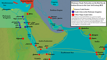
Ptolemaic Trade Networks in the Late 1st Century BCE
This map illustrates the trading networks which connected the Ptolemaic Kingdom to South Asia and East Africa by the second half of the 1st century BCE. During this time period, Ptolemaic Egypt was a major player in the spice trade which...
Image
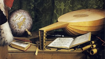
16th century CE Desk with Lute, Globe and Books
A detail of a mid-16th century CE painting by Hans Holbein the Younger showing a desk with a lute, globe and books. From 'The Ambassadors', c. 1533 CE. (National Gallery, London)
Image
Roman Forum in the 5th Century BCE
A painting of the Roman Forum as it probably would have appeared in the 5th Century BCE. By Vilius Petrauskas.
Courtesy of Ancient History Magazine / Karwansaray Publishers.
Image
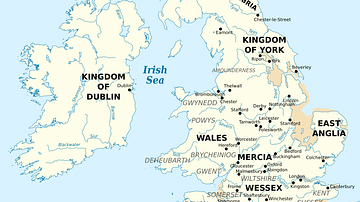
British Isles at the Beginning of the 10th Century
British Isles in 10th century represented with the coastline at the time.
Image
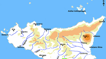
Map of Greek Sicily, 5th Century BCE
A map indicating the principal towns in Sicily during the 5th century BCE.
Image
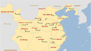
China Warlords, 2nd-3rd century CE.
A map showing the territories of the main Chinese warlords at the fall of the Han dynasty in the early 3rd century CE.
Image
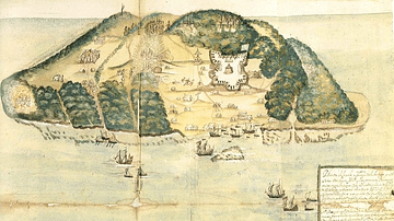
17th Century Tortuga
A 17th-century illustration of the buccaneer and pirate base of Tortuga, located on the northwest coast of Hispaniola (modern Haiti and the Dominican Republic).
Image
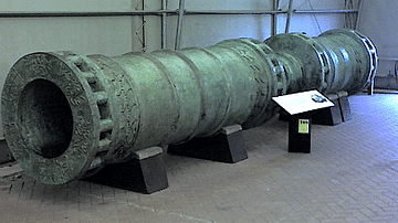
15th-century CE Ottoman Cannon
A 15th-century CE bronze Ottoman cannon based on the design of those used in the siege of Constantinople in 1453 CE by Mehmed II.
Image
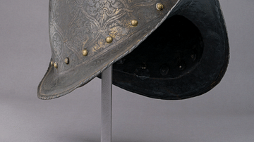
16th Century Morion Helmet
A typical steel morion helmet, a type worn across Europe in the 16th century and worn by conquistadors in the New World. Italian, c. 1570. (Metropolitan Museum of Art, New York)
Image
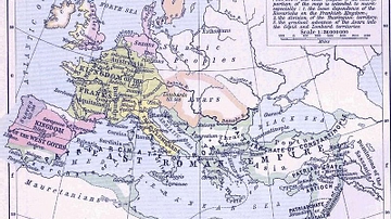
East Roman Empire, 6th century CE
East Roman Empire, 6th century CE, showing the territories of the Avars, Goths, Franks, Lombards, Saxons, Thuringians, Slavs.