
Search
Search Results
Image
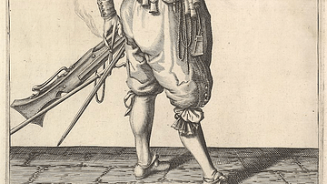
17th-century Musketeer Loading His Weapon
An illustration of a 17th-century musketeer loading his weapon. From a series of engravings in a Dutch 1608 arms manual The Exercise of Arms. (Metropolitan Museum of Art, New York)

Image
Rank Badge with Qilin (16th–Early 17th Century)
Rank badge with qilin, silk embroidery on silk gauze, unknown artist, 16th to early 17th century. This embroidered rank badge is from the Ming Dynasty (1368-1644) and was used to indicate military rank. Badges with a qilin, a Chinese mythological...
Image
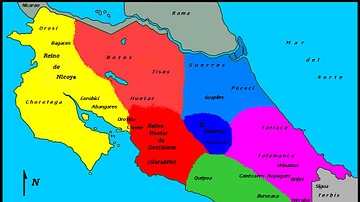
Costa Rica, 16th century CE
Map of Costa Rica in the 16th century CE.

Image
Detail of a 6th-century Elephant Mosaic
Detail of a 6th-century mosaic floor that used to decorate the pavement of the peristyle court of the Palatium Magnum, the Great Palace of Constantinople. The Great Palace Mosaic Museum houses mosaics from the Byzantine period, unearthed...
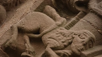
Image
Manticore at the Church of St Mary and St David, Kilpeck, Herefordshire (12th century)
Kilpeck church stone carvings: Manticore. Dating to the 12th century and found at the Church of St Mary and St David in Herefordshire, England.
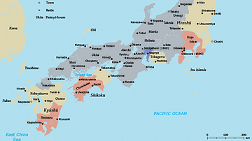
Image
Map of Japan in the 16th Century CE
A map of Japan during the Azuchi-Momoyama period (1568-1600 CE).
Image
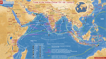
Trade in the Indian Ocean 15th-16th century
This map illustrates the Indian Ocean trade (15th–16th centuries), a vast maritime network linking East Africa, the Middle East, South Asia, and Southeast Asia, facilitating the exchange of spices, textiles, metals, timber, and luxury goods...
Image
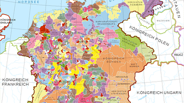
Holy Roman Empire in the 13th century CE
A map in German of central Europe during the time of the Hohenstaufen Emperors, primarily showing the territories of the Holy Roman Empire and the Kingdom of Sicily. The map is a vectorised version of this map from Professor G. Droysens...
Image
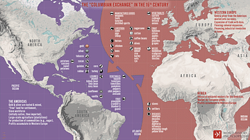
The “Columbian Exchange” in the 15th century
An infographic illustrating the exchange of diseases, animals, plants, populations, and technology between the Americas, Africa, and Eurasia in the wake of Christopher Columbus' 1492 voyage across the Atlantic, known as the "Columbian Exchange"...
Image
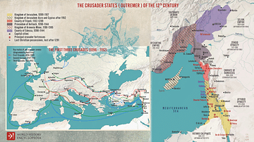
The First Three Crusades and the 12th-Century Latin East (Outremer)
Maps illustrating the trajectory of a series of early military campaigns initiated by the medieval Church between 1096–1192, aiming at liberating the "Holy Land" (roughly located between the Mediterranean Sea and the Eastern Bank of the Jordan...