
Search
Search Results
Image
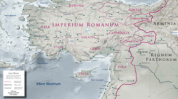
Asia Minor in the Early 1st Century CE
Map of Asia Minor in the early 1st century CE with the Kingdom of Commagene as a Roman client state.
Image
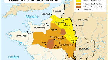
Map of France, 10th Century CE
A map of France in the 10th century CE.
Image
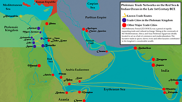
Ptolemaic Trade Networks in the Late 1st Century BCE
This map illustrates the trading networks which connected the Ptolemaic Kingdom to South Asia and East Africa by the second half of the 1st century BCE. During this time period, Ptolemaic Egypt was a major player in the spice trade which...
Image
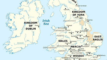
British Isles at the Beginning of the 10th Century
British Isles in 10th century represented with the coastline at the time.
Image
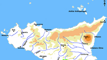
Map of Greek Sicily, 5th Century BCE
A map indicating the principal towns in Sicily during the 5th century BCE.
Image
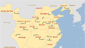
China Warlords, 2nd-3rd century CE.
A map showing the territories of the main Chinese warlords at the fall of the Han dynasty in the early 3rd century CE.
Image
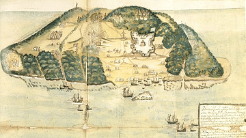
17th Century Tortuga
A 17th-century illustration of the buccaneer and pirate base of Tortuga, located on the northwest coast of Hispaniola (modern Haiti and the Dominican Republic).
Image
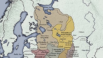
11th century CE Kievan Rus Territories
Map of Kievan Rus territories during the feudal split, after the death of Prince Yaroslav the Wise in 1054 CE.
Image
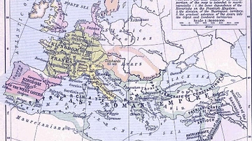
East Roman Empire, 6th century CE
East Roman Empire, 6th century CE, showing the territories of the Avars, Goths, Franks, Lombards, Saxons, Thuringians, Slavs.

Image
17th-Century Siege Artillery Tactics
An early 17th-century illustration by Johann Jacob von Wallhausen showing the tactics of batteries of siege artillery to fire upon a specific point in the defensive fortifications.