
Search
Search Results

Image
17th-Century Siege Artillery Tactics
An early 17th-century illustration by Johann Jacob von Wallhausen showing the tactics of batteries of siege artillery to fire upon a specific point in the defensive fortifications.
Image
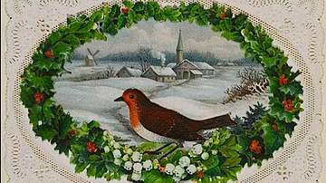
19th-Century Christmas Card
A late-19th century Christmas card showing a robin and snow scene. The border is perforated to resemble lace. (Victoria and Albert Museum, London) Orignal source note on usage: 'V&A Owned Content' in which the V&A owns copyright (or related...
Image
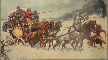
19th-Century Coach Caught in Snow
A picture of a 19th-century coach caught in the snow. From a tin produced by Excelvit. (Private Collection)
Image
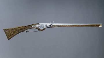
17th-Century Wheellock Carbine
A French 17th-century wheellock carbine. This type of weapon was typically used by cavalrymen, for example, during the English Civil Wars. (1642-51). This example is particularly ornate since it was possibly made for Louis XIII of France...

Image
Hydria (4th century BCE)
The hydria, as its name indicates, was used almost exclusively for carrying water (Greek hydor), essential for everyday cleansing, ritual purifications and libations. 4th-century BCE. Made from bronze. (Hellenic Museum, Melbourne, Victoria)
Image
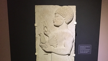
Lydian Relief: 5th Century BCE
This relief of a male holding a bird is from the 5th century BCE, found in modern day western Turkey near the ancient city of Thyatira. Thyatira was named such by Seleucos I Nicator around 290 BCE but prior to that it was an important city...
Image
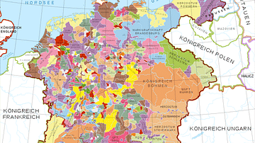
Holy Roman Empire in the 13th century CE
A map in German of central Europe during the time of the Hohenstaufen Emperors, primarily showing the territories of the Holy Roman Empire and the Kingdom of Sicily. The map is a vectorised version of this map from Professor G. Droysens...
Image
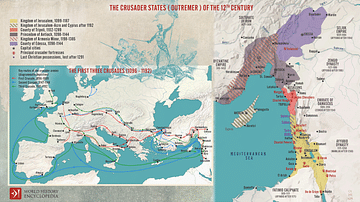
The First Three Crusades and the 12th-Century Latin East (Outremer)
Maps illustrating the trajectory of a series of early military campaigns initiated by the medieval Church between 1096–1192, aiming at liberating the "Holy Land" (roughly located between the Mediterranean Sea and the Eastern Bank of the Jordan...
Image
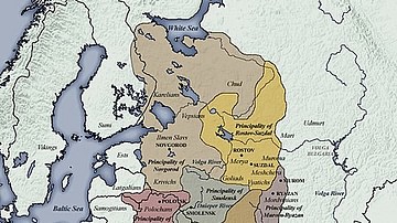
11th century CE Kievan Rus Territories
Map of Kievan Rus territories during the feudal split, after the death of Prince Yaroslav the Wise in 1054 CE.
Image
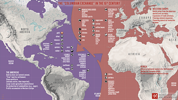
The “Columbian Exchange” in the 15th century
An infographic illustrating the exchange of diseases, animals, plants, populations, and technology between the Americas, Africa, and Eurasia in the wake of Christopher Columbus' 1492 voyage across the Atlantic, known as the "Columbian Exchange"...