
Search
Search Results
Image
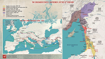
The First Three Crusades and the 12th-Century Latin East (Outremer)
Maps illustrating the trajectory of a series of early military campaigns initiated by the medieval Church between 1096–1192, aiming at liberating the "Holy Land" (roughly located between the Mediterranean Sea and the Eastern Bank of the Jordan...
Image
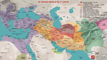
The Parthian Empire in the 2nd Century
The Parthian Kingdom (also known as Arsacid, by the name of its ruling dynasty) rose to prominence c. 247 BCE in the vacuum created by the collapse of the Seleucid Empire. In the centuries that followed, the Parthian Empire grew to encompass...
Image
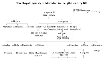
Family Tree of the Royal Dynasty of Macedon in the 4th Century BCE
Family tree of the Royal Dynasty of Macedon in the 4th Century BCE. From Unearthing the Family of Alexander the Great. Grant (2019) p76. Used with permission from Pen & Sword Books.
Image
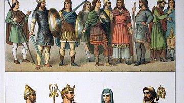
Anglo-Saxon Clothing, 6-9th century CE
An illustration of the typical clothing worn by Anglo-Saxons in medieval England, c. 500 - c. 1000 CE. ('Costumes of all Nations', 1882 CE)

Image
The Roman Empire and the Crisis of the Third Century, c. 270 CE
A map illustrating the state of affairs in the lands of the Roman Empire following the violent death of Emperor Severus Alexander in 235 CE during a period known as the Crisis of the Third Century, as multiple pretenders staked a claim to...
Image
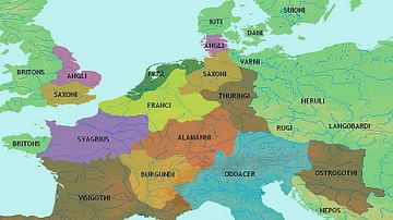
Central Europe 5th century CE
Map showing central Europe in the 5th century CE.
Image
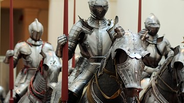
Knights in Armour, 15th century CE
Knights in armour typical of the 15th century CE. (Metropolitan Museum of Art, New York)
Image
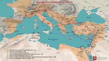
Early Christian Pilgrimage (4th-5th Century)
A map illustrating the establishment of the pilgrimage ('pilgrim' comes from the Latin word peregrinus - a stranger, someone on a journey) to holy places after Roman Emperor Constantine’s conversion to Christianity in 313 CE. The idea of...
Image
Roman Forum in the 5th Century BCE
A painting of the Roman Forum as it probably would have appeared in the 5th Century BCE. By Vilius Petrauskas.
Courtesy of Ancient History Magazine / Karwansaray Publishers.
Image
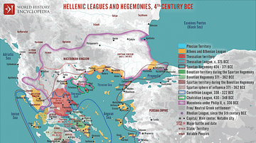
Hellenic Leagues and Hegemonies, 4th century BCE
A map illustrating the Hellenic world's dynamic political landscape in the aftermath of the Peloponnesian War (431–404 BCE) and the emergence of numerous leagues and hegemonies. These alliances formed among city-states and regions to navigate...