
Search
Search Results
Image
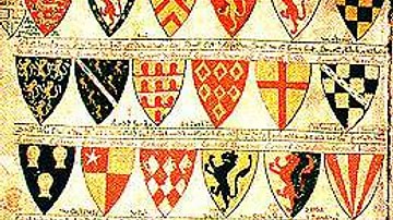
13th Century CE Roll of Arms
The oldest known English roll of arms, dating to c. 1244 CE. It is a single sheet painted on both sides by Mathew Paris and showing 75 coats of arms starting with the king’s. (British Library, London)
Image
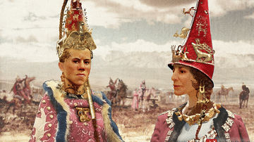
Scythian Noblewomen, 4th-3rd Century BCE
A visualization of Scythian noblewomen in traditional festive garb.
Special thanks to Patrick Scott Smith for his research and input.

Image
19th-century Drawing of Weetamoo
Drawing of Weetamoo (l. c. 1635-1676) from page 48 of Frost's Pictorial History of Indian Wars and Captivities by John Frost, 1873.
Image
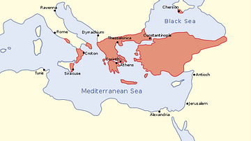
The Byzantine Empire in the mid-9th century CE
A map of the Byzantine Empire, c. 867 CE.
Image
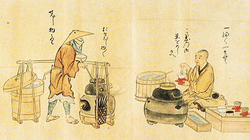
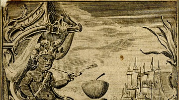
17th-century Japanese Tea Vendors
A print showing Japanese tea vendors. Edo Period, c. 1846, print from a 1632 original. Copied by Kanō Osanobu and Kanō Masanobu. (From Poetry Competition of Artisans, vol.2)
Image
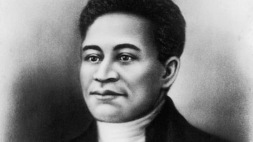
Crispus Attucks Portrait from the 19th Century
An image of Crispus Attucks created c. 1854 when he became an inspirational figure for the abolitionist movement in the United States. There is no way of knowing whether this image represents the actual Crispus Attucks.
Image
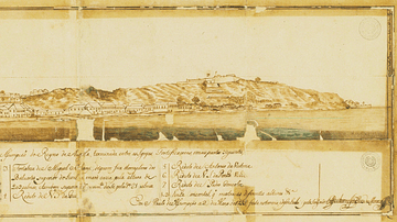
Luanda in the 18th Century
A 1755 illustration of the port of Luanda, capital of the colony of Portuguese Angola and capital of today's Angola. Luanda was one of the major points of assembly for African slaves destined for the Americas.

Image
15-century CE Nautical Map
Nautical chart of the North-East Atlantic Ocean, the Baltic Sea, the Mediterranean Sea and the Black Sea, accompanied by a circular world map.
Alleged author: Cristopher Columbus (l. 1451-1506 CE)
Gallica Digital Library
Image
18th-century CE Tobacco Paper
Tobacco paper for Sharpe's Best Virginia, at Fleet Street, London, c. 1725-1775 CE.
British Museum, London.
Image
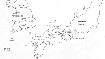
The Korean Peninsula and the Japanese Archipelago, 3rd-6th century CE
Map of Pen/Insular states and potential centres in the 3rd–6th centuries CE.