
Search
Search Results
Image
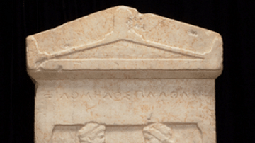
Grave Stele of a Couple, 5th Century BCE
Greek grave stele depicting a couple greeting each other, affectionately taking one hand in the other. This grave stele came from the Kerameikos in Athens and is dated to the 5th Century BCE. It is now housed in the Minneapolis Institute...
Image
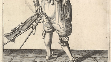
17th-century Musketeer Loading His Weapon
An illustration of a 17th-century musketeer loading his weapon. From a series of engravings in a Dutch 1608 arms manual The Exercise of Arms. (Metropolitan Museum of Art, New York)
Image
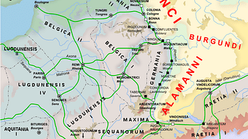
Rhine Frontier of the Roman Empire, 4th century CE.
A map showing the Rhine frontier of the Roman Empire in the 4th century CE.
Image
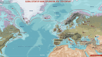
Global Extent of Viking Exploration, 8th-11th Century
A map illustrating the far-reaching voyages and settlements of the Vikings during the 8th to 11th centuries, spanning much of Europe, the North Atlantic, and parts of North America. Viking explorers and traders traveled as far west as Newfoundland...

Image
The “Columbian Exchange” in the 15th century
An infographic illustrating the exchange of diseases, animals, plants, populations, and technology between the Americas, Africa, and Eurasia in the wake of Christopher Columbus' 1492 voyage across the Atlantic, known as the "Columbian Exchange"...
Image
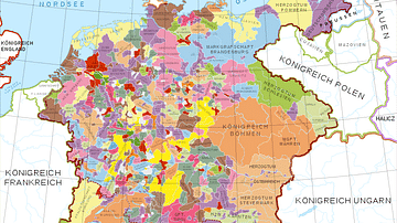
Holy Roman Empire in the 13th century CE
A map in German of central Europe during the time of the Hohenstaufen Emperors, primarily showing the territories of the Holy Roman Empire and the Kingdom of Sicily. The map is a vectorised version of this map from Professor G. Droysens...
Image
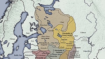
11th century CE Kievan Rus Territories
Map of Kievan Rus territories during the feudal split, after the death of Prince Yaroslav the Wise in 1054 CE.
Image
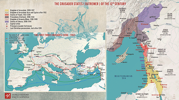
The First Three Crusades and the 12th-Century Latin East (Outremer)
Maps illustrating the trajectory of a series of early military campaigns initiated by the medieval Church between 1096–1192, aiming at liberating the "Holy Land" (roughly located between the Mediterranean Sea and the Eastern Bank of the Jordan...
Image
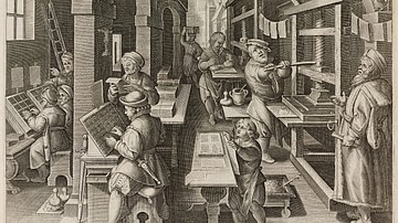
16th Century CE Flemish Book Printer
An illustration of a Flemish printer's shop, Impressio Librorum. Made in Antwerp, 1580-1605 CE. (British Museum, London)
Image
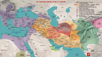
The Parthian Empire in the 2nd Century
The Parthian Kingdom (also known as Arsacid, by the name of its ruling dynasty) rose to prominence c. 247 BCE in the vacuum created by the collapse of the Seleucid Empire. In the centuries that followed, the Parthian Empire grew to encompass...