
Search
Search Results

Image
15-century CE Nautical Map
Nautical chart of the North-East Atlantic Ocean, the Baltic Sea, the Mediterranean Sea and the Black Sea, accompanied by a circular world map.
Alleged author: Cristopher Columbus (l. 1451-1506 CE)
Gallica Digital Library
Image
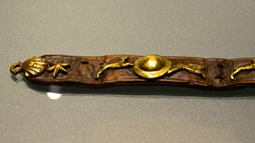
16th-Century Dog Collar
Dog collar found in Amsterdam, dated to 1575-1600.
Rijksmuseum van Oudheden, Leiden.
Image
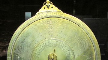
10th-century Equatorium
Equatorium of Jafar al-Khazin (900-971 CE).
Istanbul Museum of the History of Science and Technology in Islam.

Image
19th-century Drawing of Weetamoo
Drawing of Weetamoo (l. c. 1635-1676) from page 48 of Frost's Pictorial History of Indian Wars and Captivities by John Frost, 1873.
Image
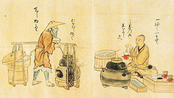
17th-century Japanese Tea Vendors
A print showing Japanese tea vendors. Edo Period, c. 1846, print from a 1632 original. Copied by Kanō Osanobu and Kanō Masanobu. (From Poetry Competition of Artisans, vol.2)
Image
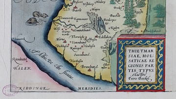
16-century Map of Dithmarshen
Dithmarschen in the Theatrum Orbis Terrarum by Abraham Ortelius, 1570
Image
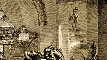
Columbarium Being Stripped Bare by 18th-Century Treasure Hunters
From the 15th-18th centuries CE, the many columbaria that lined the consular highways leading out of Rome were plundered and destroyed. Consequently, one sees bits and pieces of them cemented into the walls of villas and palazzos all over...
Image
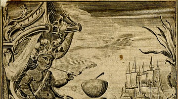
18th-century CE Tobacco Paper
Tobacco paper for Sharpe's Best Virginia, at Fleet Street, London, c. 1725-1775 CE.
British Museum, London.
Image
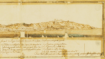
Luanda in the 18th Century
A 1755 illustration of the port of Luanda, capital of the colony of Portuguese Angola and capital of today's Angola. Luanda was one of the major points of assembly for African slaves destined for the Americas.
Image
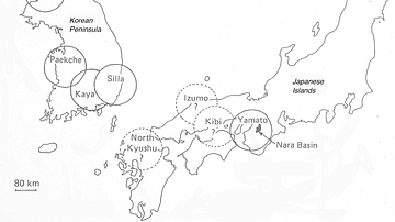
The Korean Peninsula and the Japanese Archipelago, 3rd-6th century CE
Map of Pen/Insular states and potential centres in the 3rd–6th centuries CE.