
Search
Search Results
Image
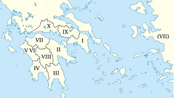
Pausanias' locations in his Description of Greece
Map based on Description of Greece by Pausanias. The map shows which parts of Greece each book in the work describes.

Image
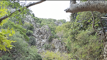
The Foothills of Mt. Chortiatis, Greece
The landscape from the top of Mt. Chortiatis. In the background, the hinterland of the mountainous Chalcidice emerges. In antiquity, the mountain was called Cissus, which means ivy. The locals could have chosen the mountain's name either...
Image
A Pond in Samothrace, Greece
A beautiful pond emerges from the waterfall deriving from Mt. Saos, Samothrace.

Definition
Pausanias (Geographer)
Pausanias was a Greek author, historian, and geographer of the 2nd century CE who journeyed extensively throughout Greece, chronicling these travels in his Periegesis Hellados or Description of Greece. His ten volumes of observations are...
Image
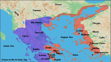
Map of Archaic Greece
A map of the political structure of Greece in the Archaic Age (ca. 750 - 490 BC).

Interview
Interview: The First Black Archaeologist: A Life of John Wesley Gilbert by John Lee
John Lee joins World History Encyclopedia to tell us all about his new book, The First Black Archaeologist: A Life of John Wesley Gilbert. Kelly (WHE): Thank you so much for joining me! Let us start by talking about what the book is about...

Video
Delphi, Greece: Spectacular Ancient Site
Ancient Delphi, perched high on the slopes of Mt. Parnassos, was not a city. It was the site of the oracle of Apollo, god of the sun. People would journey here from all over the known world to seek wisdom from the gods on vital affairs of...
Image
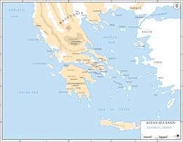
Map of Classical Greece
A map showing classical Greece and the Aegaean islands.
Image
Pausanias' Description of Greece Map
Map epicting locations described in Pausanias' Description of Greece, as found in the version translated and with a commentary by J. G. Frazer. Photograph by the British Library.

Image
The Temple of Aphaia, Aegina, Greece
Temple of the local fertility goddess Aphaia, Aegina, Greece, c. 500 BCE.