Search
Search Results
Article
Enemies of Rome in the 3rd Century CE
It has been said that the greatest enemy of Rome was Rome itself, and this is certainly true of the period known as the Crisis of the Third Century (also known as the Imperial Crisis, 235-284 CE). During this time of almost 50 years, over...
Lesson Pack
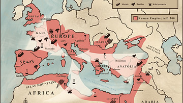
Roman Economy & Trade
We have prepared three lesson plans including classroom activities, assignments, homework, and keys as well as: Glossary of keywords and concepts in an excel format Open questions adaptable for debates, presentations, and essays Recommended...

Worksheet/Activity
Pax Romana - Web Quest
This activity has been designed to fit a 20-minute slot for your class and is suitable for both online and classroom teaching, as well as homeschooling. Students have to complete a web quest, based on multiple articles (also available as...
Worksheet/Activity
Roman Food - Map & Questions
This activity has been designed to fit a 20-30-minute slot for your class and is suitable for both online and classroom teaching. Students have to answer a few questions based on a map. It is part of our Daily Life in Ancient Rome pack...

Video
Queens of Jerusalem with Katherine Pangonis
Katherine Pangonis' new book Queens of Jerusalem: The Women Who Dared to Rule sheds light on the somewhat overlooked women, queens and princesses of Outremer (the Crusader States). The book is about a dynasty of women who ruled in the Middle...
Image
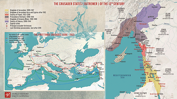
The First Three Crusades and the 12th-Century Latin East (Outremer)
Maps illustrating the trajectory of a series of early military campaigns initiated by the medieval Church between 1096–1192, aiming at liberating the "Holy Land" (roughly located between the Mediterranean Sea and the Eastern Bank of the Jordan...
Image
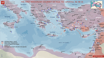
Paul the Apostle's First Missionary Journey (c. 46-48 CE)
Paul the Apostle undertook multiple missionary journeys across the Roman Empire to spread Christianity, establish churches, and strengthen the faith of early Christians. Paul's first missionary journey, accompanied by Barnabas and John Mark...
Image
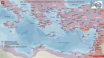
Paul the Apostle's Second Missionary Journey (c. 49-52 CE)
Paul the Apostle undertook multiple missionary journeys across the Roman Empire to spread Christianity, establish churches, and strengthen the faith of early Christians. Paul's second missionary journey, accompanied by Silas and later joined...
Image
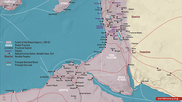
Roman Rule in the Levant, c. 200 CE
This map illustrates the Roman Levant c. 200 CE, encompassing the provinces of Syria Coele, Syria Phoenice, Judea (renamed Syria Palaestina), and Arabia Petraea. It was a culturally diverse and strategically vital region, serving as a trade...
Image
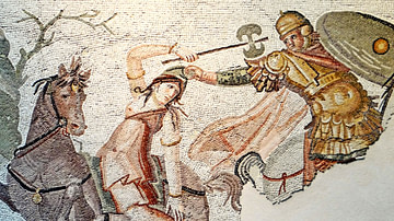
Mosaic of Amazon Warrior Fighting Greek Rider
An ancient Roman mosaic from the 4th century CE depicting an Amazon warrior in mounted combat against a Greek rider. The Greek is seizing the Phrygian cap of the Amazon. Cropped detail of a mosaic from Daphne, a suburb of Antioch on the Orontes...