
Search
Search Results
Image
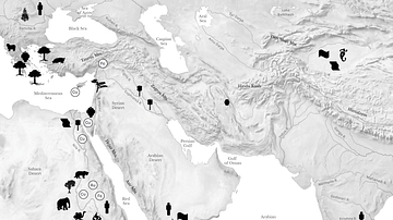
Resource Map of the Ancient Middle East
Map showing some of the major regional resouces of the eastern Mediterranean, the Near East, East Africa, and Central and South Asia.

Image
Dutch East India Company Trading Regions
Map of East India, taken from the Atlas van der Hagen, Koninklijke Bibliotheek, The Hague Part 4. This map of South East Asia was published by Nicolaas Visscher II (1649-1702). The map shows the entire trading region of the Dutch East India...
Image
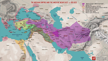
The Median Empire and the Ancient Near East, c. 600 BCE
A map illustrating the rise and expansion of the Median Empire in the wake of the Bronze Age Collapse and the disintegration of the Neo-Assyrian Empire (c. 609 BCE). While the Neo-Babylonian Empire engulfed the Fertile Crescent from the Levantine...
Image
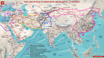
Trade Links between the Roman Empire and the East (1st - 3rd centuries)
A map illustrating the ever-growing and ever-changing trade network of maritime and overland routes connecting China, India, and the Far East with the Middle East and Europe. Even though the term "Silk Road" was not defined until the late...
Image
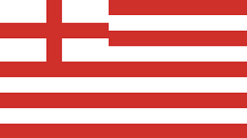
Original Flag of the English East India Company
The original flag of the English East India Company (EIC), founded in 1600 by royal charter. The company later changed its name to the British East India Company and so the cross of St. George in the top right corner was replaced by a Union...
Image
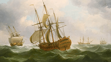
East Indiamen in a Gale
A c. 1759 painting by Charles Brooking East Indiamen in a Gale showing ships of the East India Company. (Royal Museums Greenwich)
Image
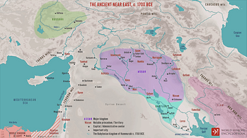
The Ancient Near East, c. 1700 BCE
A map illustrating the political situation in the Ancient Near East during the Old Assyrian period (around 1700 BCE) shortly before the rise of the Babylonian Empire of Hammurabi. It depicts the rise of Assur from an independent city-state...

Image
Britannia Receiving the Riches of the East
A 1778 allegorical painting commissioned by the East India Company showing the riches of the East being presented to Britannia. Painted by Spyridon Romas. The goods shown include tea, porcelain, and jewels. (British Library, London)
Image
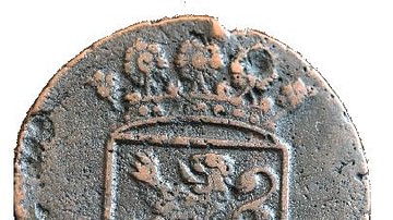
Dutch East India Company Coinage
The front and reverse of a Dutch East India Company duit - an old Dutch copper coin.
Image
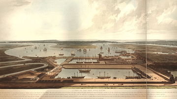
East India Docks
An 1808 coloured print showing the docks of the East India Company, known as the East India Docks, at Blackwall in London. (British Museum, London).