Search
Search Results

Image
East India Docks
An 1808 coloured print showing the docks of the East India Company, known as the East India Docks, at Blackwall in London. (British Museum, London).

Article
The Journeys of Paul the Apostle
The journeys of Paul the Apostle, as the New Testament relates in the Book of Acts, started with his conversion experience on the way to Damascus, after which instead of seeking to thwart the growing Christian movement, he helped spread it...

Image
Plate with Monogram of the Dutch East India Company
A plate from the Edo period (1615-1868) in Arita, Saga Prefecture in Japan, 1670-1740. "VOC" is the monogram for the Dutch East India Company, whose name in Dutch is Vereenigde Oostindische Compagnie. Inspired by contemporary and previous...

Image
Ancient Near East c.1500-1300 BCE - The Old Hittite Collapse and the Rise of Kassites, Mitanni, and the New Kingdom of Egypt
This map illustrates the geopolitical landscape of the ancient Near East following the destructive campaigns of the Old Hittite Empire (circa 1650–1500 BCE), which triggered widespread upheaval and realigned regional power structures. In...

Image
Robert Clive & The East India Company Rule in India, c. 1765
A map illustrating the transformation of the East India Company from a hopeful merchant venture in 1600 with isolated trade outposts governed by isolated and mostly independent town councils into a major ruler of large territories in India...

Image
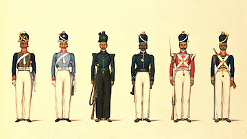
East India Company Madras Uniforms
A c. 1830 illustration by Yellapah of Vellore showing six Sepoy uniforms of the East India Company Madras army. From left to right: - Madras Horse Artillery - Madras Light Cavalry - Madras Rifle Corps - Madras Pioneers - Madras...

Image
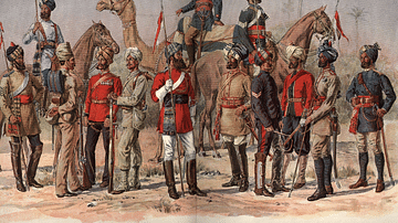
East India Company Madras Army
A 19th-century illustration showing officers and sepoys (Indian recruits) of the East India Company's Madras army.

Image
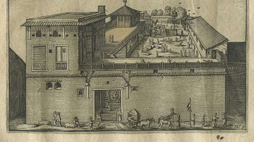
Dutch East India Company's Warehouse and Living Quarters
Dutch East India Company's warehouse and living quarters in Surat, India, as seen in April 1629 by Pieter van den Broecke (1585-1640), a Dutch cloth merchant in the service of the VOC.

Image
East India Company Trooper & Sepoy
An 1839 illustration showing a trooper and sepoy (Indian recruit) of the East India Company army. 27th Regiment of Madras Native Infantry. (British Library, London)

Image
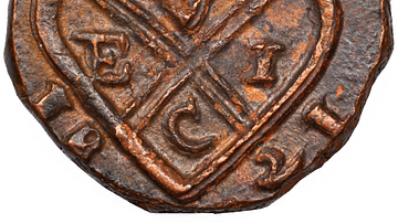
Copper Coin of the East India Company
A copper coin minted by the British East India Company (EIC). From Bombay, 1821.