
Search
Search Results
Image
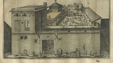
Dutch East India Company's Warehouse and Living Quarters
Dutch East India Company's warehouse and living quarters in Surat, India, as seen in April 1629 by Pieter van den Broecke (1585-1640), a Dutch cloth merchant in the service of the VOC.
Image
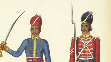
East India Company Trooper & Sepoy
An 1839 illustration showing a trooper and sepoy (Indian recruit) of the East India Company army. 27th Regiment of Madras Native Infantry. (British Library, London)
Image
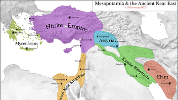
Map of Mesopotamia and the Ancient Near East, c. 1300 BCE
Map of Mesopotamia and the Ancient Near East c. 1300 BCE, showing the period of Great Powers, with the six large kingdoms and empires (the Hittites, the Mycenaean Civilization, Assyria, Babylonia, Elam and the New Kingdom of Egypt) co-existing...
Image
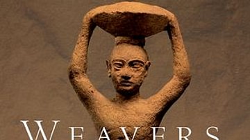
Weavers, Scribes, and Kings: A New History of the Ancient Near East by Amanda H. Podany
Weavers, Scribes, and Kings: A New History of the Ancient Near East by Amanda H. Podany
Image
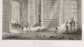
Opium Warehouse of the East India Company
A c. 1850 print showing an opium warehouse of the East India Company in Patna, India. Opium was dried into large balls and then packed into chests for transportation to China.
Image
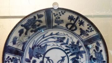
Dutch East India Company Logo
Blue and white Dutch East India Company (Vereenigde Oostindische Compagnie or VOC) logo from 1650-1674. Made in Japan to order by the company's directors in Batavia (Jakarta). Date between 1615 and 1674.
Image
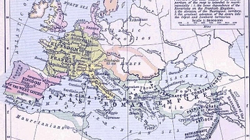
East Roman Empire, 6th century CE
East Roman Empire, 6th century CE, showing the territories of the Avars, Goths, Franks, Lombards, Saxons, Thuringians, Slavs.
Image
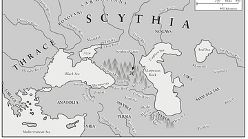
Traditional Scythian-Occupied Region East of Ukraine
A map of the traditional areas inhabited by the Scythians, stretching east from the Ukraine.
Image
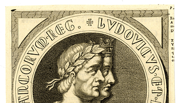
Emperor Charles the Fat & King Louis III the Younger of East Francia
Engraved portrait of Kings of East Francia Charles the Fat (r. 876-887 CE), Holy Roman Emperor (r. 881-887 CE), and Louis III the Younger (r. 876-882 CE), by unknown creator, c. 1634-1643 CE.
The British Museum, London.
Image
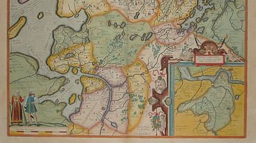
Map of East Frisia
Map of East Frisia by the Dutch Johannes Florianus (1522-1585) for the Theatrum Orbis Terrarum, one of the first accurate modern atlas, 1595.