
Search
Search Results
Image
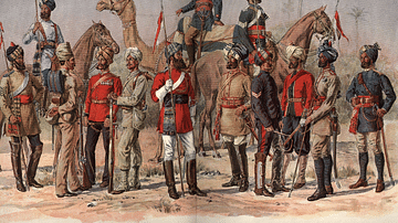
East India Company Madras Army
A 19th-century illustration showing officers and sepoys (Indian recruits) of the East India Company's Madras army.
Image
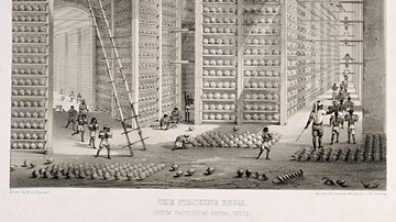
Opium Warehouse of the East India Company
A c. 1850 print showing an opium warehouse of the East India Company in Patna, India. Opium was dried into large balls and then packed into chests for transportation to China.
Image
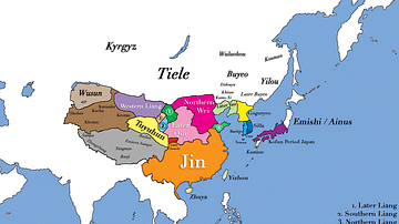
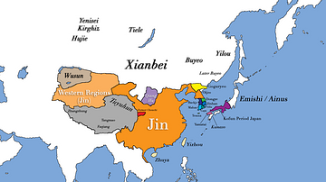
East Asia in 400 CE
This map shows all major civilizations of East Asia at the beginning of 4th century CE. Italicized texts indicate nomadic bands or tribal societies.
Image
East Asia in 500 CE
This map shows the territories of all major civilizations in East Asia in the year 500 CE. Italicized texts indicate nomadic bands or tribal societies.
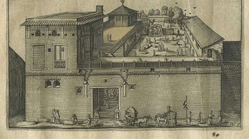
Image
Dutch East India Company's Warehouse and Living Quarters
Dutch East India Company's warehouse and living quarters in Surat, India, as seen in April 1629 by Pieter van den Broecke (1585-1640), a Dutch cloth merchant in the service of the VOC.
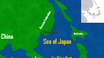
Image
Map of East Asia
A map of East Asia showing China, Korea and Japan.
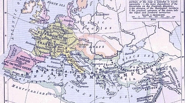
Image
East Roman Empire, 6th century CE
East Roman Empire, 6th century CE, showing the territories of the Avars, Goths, Franks, Lombards, Saxons, Thuringians, Slavs.
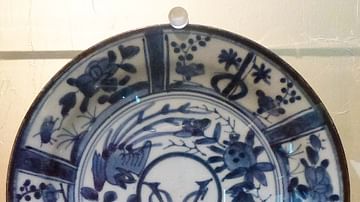
Image
Dutch East India Company Logo
Blue and white Dutch East India Company (Vereenigde Oostindische Compagnie or VOC) logo from 1650-1674. Made in Japan to order by the company's directors in Batavia (Jakarta). Date between 1615 and 1674.
Image
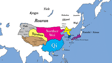
East Asia circa 300 CE
This map shows all major civilizations of East Asia at the beginning of the 3rd century CE. Italicized texts indicate nomadic bands or tribal societies.
Image
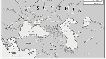
Traditional Scythian-Occupied Region East of Ukraine
A map of the traditional areas inhabited by the Scythians, stretching east from the Ukraine.