
Search
Search Results

Definition
Roman Empire
The Roman Empire, at its height (c. 117), was the most extensive political and social structure in western civilization. Building upon the foundation laid by the Roman Republic, the empire became the largest and most powerful political and...
Image
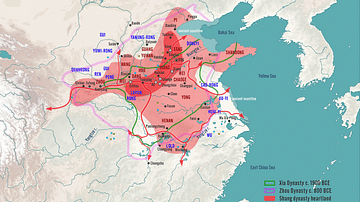
Shang Dynasty of China, c. 1100 BCE
A map illustrating the rise and expansion of the Bronze Age Shang dynasty of China in the second millennium BCE following the overthrowing of the Xia dynasty. Established around 1600 BCE, on the North China Plain, the Shang ruled by a single...

Definition
Old Kingdom of Egypt
The Old Kingdom of Egypt (c. 2613-2181 BCE) is also known as the 'Age of the Pyramids' or 'Age of the Pyramid Builders' as it includes the great 4th Dynasty when King Sneferu perfected the art of pyramid building and the pyramids of Giza...
Image
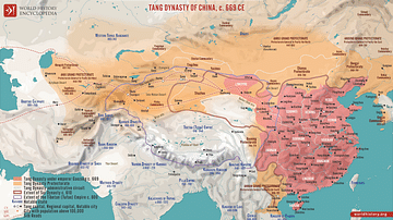
Tang Dynasty of China, c. 669 CE
A map illustrating the Tang Dynasty of China at its greatest extent under the rule of Emperor Gaozong, encompassing modern-day China, parts of Central Asia, and the Korean Peninsula. Around 669, the Empire reached its pinnacle of economic...

Image
Gupta Dynasty India, 320 - c. 550 CE
A map illustrating the rise to power and expansion of the Gupta dynasty in India. Once rulers of the Magadha (now Bihar) kingdom, between the early 300s and mid-500s, they held an empire in northern and parts of central and western India...
Image
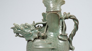
Celadon Fish-Dragon Ewer, Goryeo Dynasty
A celadon fish-dragon ewer. 12th century CE, Goryeo Dynasty, Korea. (National Museum of Korea, Soul, South Korea)
Image
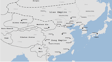
Liao Dynasty Map
A map indicating the territory controlled by the Liao dynasty (Khitans), 907-1125 CE.
Image
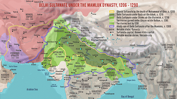
Delhi Sultanate under the Mamluk Dynasty, 1206-1290
A map illustrating the rise and evolution of the Sultanate of Delhi during the times of its first ruling dynasty – the Mamluks (also known as the Slave or Ghulam Dynasty), an influential military class of slave soldiers between 1206 and 1290...
Image
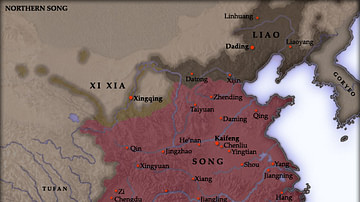
Northern Song Dynasty Map
A map indicating the territory of the Northern Song Dynasty of China, 960-1125 CE.

Image
Map of the Ming Dynasty Territory
A map indicating the territory controlled by the Ming Dynasty (1368 to 1644 CE) in the late 16th century CE.