
Search
Search Results
Image
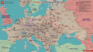
Holocaust in Europe during World War Two
This map illustrates the scale and scope of the Holocaust in Europe during World War II, a systematic, state-organized persecution and murder of approximately six million Jews, alongside millions of other victims, by Nazi Germany and its...

Image
Europe at the Peace of Westphalia, 1648
A map illustrating the situation in Europe after the Peace of Westphalia was signed in Osnabrück and Münster between May and October 1648. The two treaties ended the Thirty Years’ War (initially a war between various Protestant and Catholic...
Image
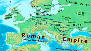
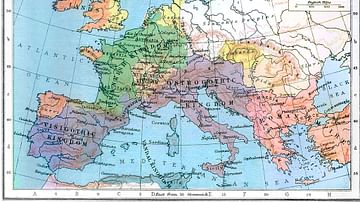
Map of Europe, 400 CE
Map of Europe in 400 CE
Image
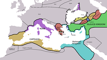
Map of Europe in 220 BC
Approximate borders in Europe around 220 BC. Based on the Pengiun Atlas of History.
Image
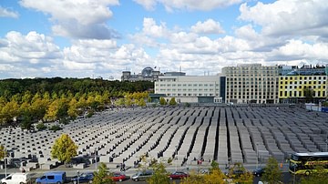
Memorial to the Murdered Jews of Europe
A view of the Memorial to the Murdered Jews of Europe, a memorial in Berlin to the Jewish victims of the Holocaust (1941-1945), from the Ministergärten. Designed by New York architect Peter Eisenman, the memorial covers 19,000 square metres...
Image
Europe in 526 CE
Europe in 526 CE.
Image
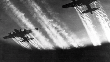
B17 Flying Fortresses over Europe
A photograph of USAAF Boeing B-17 Flying Fortresses flying over Europe during the Second World War (1939-45).
Image
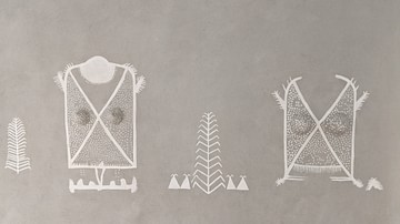
Oldest Mural in Europe
This photo shows a reconstruction of the "Cult Wall" of Ludwigshafen, the oldest mural in Europe. The original painting was created around 3860 BCE, depicting hunting trophies of aurochs and bison, fine textiles, as well as a human torso...
Image
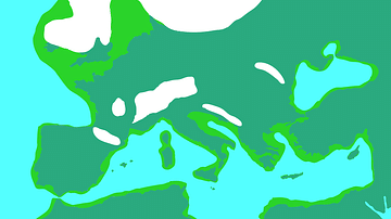
Europe During the Last Glacial Maximum
Europe during the most recent glacial, in which the ice sheets reached peak growth between c. 26.500 to c. 19,000 years ago. This is known as the Last Glacial Maximum. Sea levels were lower than today.
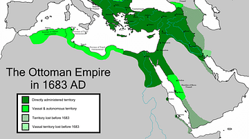
Image
The Greatest Extent of the Ottoman Empire in Europe (1683 CE)
A depiction of the Ottoman Empire and its dependencies in 1683 CE, with an indication of territory held prior to that date.