Search
Search Results

Image
Clay Stove from Central Europe
Replica of a 16th-century earthenware stove with decorative tiles from around Šenkvice. Slovak National Museum, Bratislava. Central European clay stoves emerged in the late medieval period as an evolution of the traditional dome-shaped...

Image
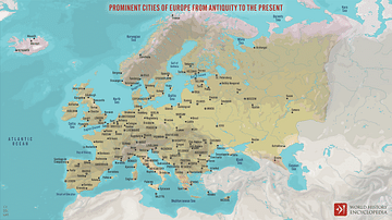
Prominent Cities of Europe from Antiquity to the Present
A map of Europe displaying important cities that shaped its history, from antiquity to the present. Cities on the map represent key centers throughout history. Each city represents a distinct period from Athens, Rome, and Constantinople (now...

Collection
Daily Life in a Medieval Monastery
Monasteries and other religious institutions such as priories and nunneries were a quintessential part of the medieval landscape and an important component of a community's social fabric. Providing spiritual guidance, employment, education...

Image
Europe after The Treaty of Versailles
This map illustrates the situation in Europe in November 1920 in the aftermath of First World War (1914-18), as the continent was reshaped by the Treaty of Versailles (1919) and the Treaty of Sèvres (1920). The German Empire had collapsed...

Image
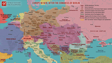
Europe in 1878 after the Congress of Berlin
The Unification of Italy and the Creation of Germany in the mid-19th century, alongside the Congress of Berlin in 1878, redefined the political landscape of Europe, consolidating fragmented states into unified nations while reshaping alliances...

Image
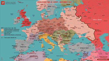
World War Two in Europe, November 1942
A map depicting the strategic situation in Europe and the Mediterranean in early November 1942, as World War II reached a critical turning point. Axis expansion had begun to reverse, while the Allies launched major offensives in North Africa...

Image
Europe at the End of World War One, November 1918 - Lost Empires, Uncertain Borders, and New Nations
This map illustrates the geopolitical landscape of Europe in mid-November 1918, immediately following the end of World War I (The Great War or First World War). The Armistice of Compiègne, signed on November 11, ended one of the deadliest...

Image
Europe on the Eve of the First World War, 1914
A map illustrating the situation in Europe as it teetered on the brink of World War I (1914-18). The political landscape was marked by intricate alliance systems and fierce imperial rivalries among European powers, especially between the...

Image
The Spread of the Plague in Europe, 1346 - 1353
A map illustrating the rapid spread of the 14th-century plague pandemic commonly known as the "Black Death", across Europe and the Middle East. The second such pandemic (after the 541 - 549 outbreak during the reign of the Roman emperor Justinian...

Image
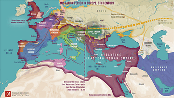
Migration Period in Europe During the 4th & 5th Century
A map illustrating migrations of various peoples across fractured Europe and Western Asia after the division of the Roman Empire at the end of the 4th Century CE.