
Search
Search Results
Image
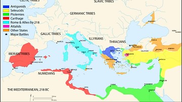
Map of the Mediterranean 218 BCE
A map of the Mediterranean in 218 BC, showing the territorial extents of the following states:
- Antigonids
- Attalids
- Carthage
- Ptolemies
- Roman Empire
- Seleucids
Major battle locations are also shown.
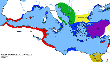
Image
Map of the Mediterranean 550 BC
A map of the Mediterranean around 550 BC, showing the major cultures:
Greece and its colonies
Phoenicia and its colonies
Lydia
Egypt
Persia
Thrace
Illyria
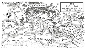
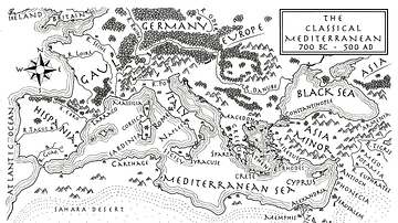
Image
An Illustrated Map of the Mediterranean from 700 BCE to 500 CE (From the Novel "The Jericho River")
An illustrated map of the Mediterranean from 700 BCE to 500 CE. From the novel The Jericho River by David Tollen.
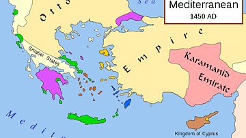
Image
Map of Eastern Mediterranean in 1450 CE
Geopolitical climate in the Eastern Mediterranean before the conquest of Constantinople in 1453 CE.

Image
Empires of the Mediterranean, 218 BCE.
A map showing the various empires throughout the Mediterranean in 218 BCE.
Image
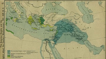
The Assyrian Empire and the Region about the Eastern Mediterranean, 750-625 BC
The Assyrian Empire and the Region about the Eastern Mediterranean, 750-625 BC.
Image
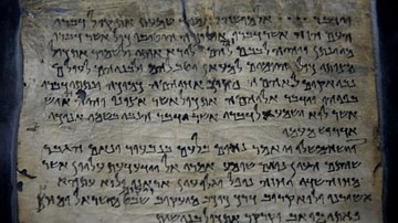
Dead Sea Scroll Testimonia from Qumran
Dead Sea Scroll number 175 (4Q175), which was found in Cave 4 at Qumran (Khirbet Qumran or Wadi Qumran), West Bank of the Jordan River, near the north part of the Dead Sea, modern-day State of Israel. It is also known as "The Testimonia"...
Image
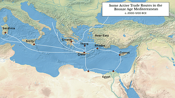
Some Active Trade Routes in the Bronze Age Mediterranean
A map detailing some of the active maritime trade routes in the Aegean during the Middle and Late Bronze Age.
Image
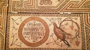
Byzantine Floor Mosaic from Eastern Mediterranean
This exceptional mosaic likely comes from the floor of a house or public building. It reflects the Late Romand and Early Byzantine taste for intricate and colorful designs. It dates from c. 325-350 CE and is made of limestone tesserae. The...
Image
Mediterranean Map
Mediterranean Map from the novel The Jericho River.