
Search
Search Results
Image
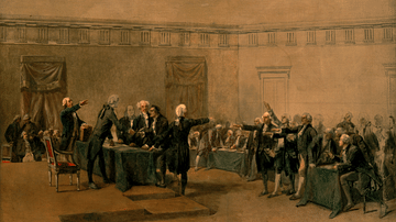
The Declaration of Independence of the United States of America
The Declaration of Independence of the United States of America, July 4, 1776, oil on canvas by Charles Édouard Armand-Dumaresq, c. 1873.
White House Cabinet Room, Washington, D.C.
Image
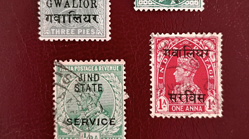
Indian Princely States Postage Stamps
Four examples of British India postage stamps issued with overprints for use in particular Indian princely states. Top left: Queen Victoria, Gwalior, 1904 Top right: Queen Victoria, Patiala, 1895 Bottom left: King George V, Jind State...

Image
Warring States Helmet
A bronze helmet from the Yin state. Warring States Period (481-221 BCE).

Image
Warring States Period Swords
Swords of the Warring States Period (481-221 BCE) in China. The left sword is of iron while the other two are of bronze. (Shaanxi Provincial Museum, Xian, China)
Image
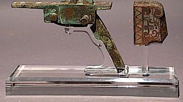
Warring States Crossbow Trigger
The trigger and firing mechanism of a crossbow from the Chinese Warring States Period, 3rd century BCE (possible a century later during the Han Dynasty). Bronze inlaid with silver.
Image
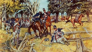
Legion of the United States at Fallen Timbers
Legion of the United States at the Battle of Fallen Timbers (20 August 1794). Painting by H. Charles McBarron, Jr.
Center for Military History.
Article
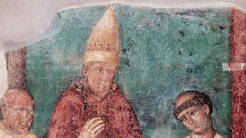
Unam Sanctam: Spiritual Authority & the Medieval Church
The Unam Sanctam (1302) was a papal bull issued by Pope Boniface VIII (served 1294-1303) requiring the complete submission of all people, including kings, to the authority and dictates of the pope. As the Church was understood as holding...

Article
Medieval Indulgence & Martin Luther
The medieval indulgence was a writ offered by the Church, for money, guaranteeing the remission of sin, and its abuse was the spark that inspired Martin Luther's 95 Theses. Luther (l. 1483-1546) claimed the sale of indulgences was unbiblical...
Image
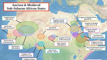
Map of Ancient & Medieval Sub-Saharan African States
A map indicating the major ancient and medieval states in sub-Saharan Africa. Areas and dates relate to a state at its peak. In addition, shaded areas are approximate indicators only. For the majority of the states, their precise borders...
Image
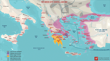
The Greek City-states c. 500 BCE
A map illustrating the city-states of Classical Greece around 500 BCE and depicting the expansion of Hellenic influence along the coasts of the Mediterranean and Black sea and the formation and scope of the Delian League, under Athenian hegemony...