Search
Search Results

Definition
Ancient Armenia
Ancient Armenia, located in the south Caucasus area of Eurasia, was settled in the Neolithic era but its first recorded state proper was the kingdom of Urartu from the 9th century BCE. Incorporated into the Persian Empire of Cyrus the Great...
Definition
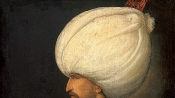
Suleiman the Magnificent
Suleiman the Magnificent (aka Süleyman I or Suleiman I, r. 1520-1566) was the tenth and longest-reigning sultan of the Ottoman Empire. Hailed as a skilled military commander, a just ruler, and a divinely anointed monarch during his lifetime...

Image
The Merovingian Dynasty, c. 639
This map illustrates the rise and expansion of the Merovingians, a Frankish dynasty that, by the late 5th century, unified the fragmented tribes of present-day France, Germany, the Low Countries, Switzerland, and Austria. Beginning with Clovis...
Image
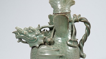
Celadon Fish-Dragon Ewer, Goryeo Dynasty
A celadon fish-dragon ewer. 12th century CE, Goryeo Dynasty, Korea. (National Museum of Korea, Soul, South Korea)
Image
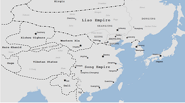
Liao Dynasty Map
A map indicating the territory controlled by the Liao dynasty (Khitans), 907-1125 CE.

Definition
Great Wall of China
The Great Wall of China is a barrier fortification in northern China running west-to-east 13,171 miles (21,196 km) from the Jiayuguan Pass (in the west) to the Hushan Mountains in Liaoning Province in the east, ending at the Bohai Gulf. It...

Image
Delhi Sultanate under the Mamluk Dynasty, 1206-1290
This map illustrates the foundation and expansion of the Delhi Sultanate under the Mamluk Dynasty (also spelled Mameluke, Arabic: مملوك, mamlūk, meaning "one who is owned," a slave), which ruled northern India from 1206 to 1290. Established...
Definition
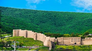
Derbent
Derbent (sometimes "Derbend" or "Darbend") is an ancient city located along the Caspian Sea in what is present-day Russia. Although the area in and around Derbent has been continuously inhabited since at least the 8th century BCE, Shah Yazdegerd...
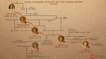
Image
Julio-Claudian Dynasty of the Roman Empire
A depiction of the evolution of the first imperial dynasty of ancient Rome, the Julio-Claudians that began with Augustus (Julius Caesar's adopted son) and included the reigns of Tiberius, Caligula, Claudius, and Nero. During their time, Rome...

Image
Tang Dynasty Provinces c. 742 CE
The provinces of the Tang Dynasty c. 742 CE. The Tang Dynasty (618-907 CE) is regularly cited as the greatest imperial dynasty in ancient Chinese history. It was a golden age of reform and cultural advancement, which lay the groundwork for...