
Search
Did you mean: Picts?
Remove Ads
Advertisement
Search Results
Definition
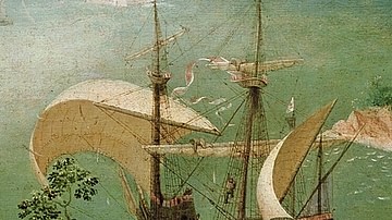
Carrack
The carrack (nao in Spanish, nau in Portuguese, and nef in French) was a type of large sailing vessel used for exploration, to carry cargo, and as a warship in the 15th and 16th centuries. Famous carracks include the Santa Maria of Christopher...

Definition
Nicodemus
Nicodemus was an early follower of Jesus Christ, uniquely mentioned only in the fourth gospel, the Gospel of John. According to that gospel, he was a Pharisee and a member of the Sanhedrin (the Jewish Council) in Jerusalem at the time...

Definition
Silk Road
The Silk Road was a network of ancient trade routes, formally established during the Han Dynasty of China in 130 BCE, which linked the regions of the ancient world in commerce between 130 BCE-1453 CE. The Silk Road was not a single...

Definition
Egyptian Medicine
Medical practice in ancient Egypt was so advanced that many of their observations, policies, and commonplace procedures would not be surpassed in the west for centuries after the fall of Rome and their practices would inform...

Definition
Linear B Script
Linear B script was the writing system of the Mycenaean civilization of the Bronze Age Mediterranean. The syllabic script was used to write Mycenaean Greek from c. 1500 to c. 1200 BCE. It was deciphered by Michael Ventris in 1952...

Definition
Gupta Empire
The Gupta Empire stretched across northern, central and parts of southern India between c. 320 and 550 CE. The period is noted for its achievements in the arts, architecture, sciences, religion, and philosophy. Chandragupta I (320...

Definition
Estado da India
The Estado da India (1505-1961) was the name the Portuguese gave to that part of their empire which stretched from India to East Asia. However, in its widest sense, the name includes all Portuguese colonies east of the Cape of...

Image
Map of the Trade Networks in the Middle Ages, c. 1200
By the early 13th century (c. 1200 CE), long-distance trade networks across Eurasia and the Mediterranean had regained a level of interconnectivity not seen since late antiquity. After the political...

Image
Map of the Trade in the Indian Ocean 15th–16th Centuries - Monsoon Routes, Spice Trade, and European Expansion
Indian Ocean trade in the 15th and 16th centuries connected East Africa, Arabia, Persia, India, Southeast Asia, and China through an extensive maritime...

Collection
History by the Numbers, Volume II - 12 More Visual Stories of Power, Science & Discovery
History by the Numbers, Volume II brings together twelve visual infographics exploring rulers, warfare, exploration, science, technology, belief, and cultural exchange across...
