
Search
Search Results
Definition
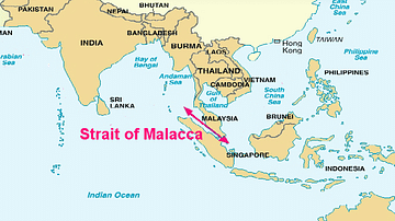
Portuguese Malacca
The Portuguese colonised Malacca (modern Melaka) on the southwest coast of the Malay peninsula from 1511 and kept it until 1641 when the Dutch took over. The port controlled the Malay Straits which lead from the Indian Ocean (the Andaman...
Image
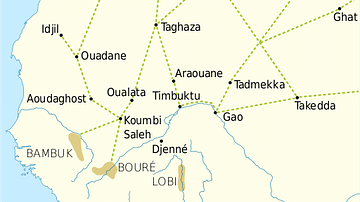
Trans-Saharan Trade Routes
A map indicating the major trans-Saharan trade routes across West Africa c. 1100-1500 CE. The darker yellow areas indicate gold fields.
Image
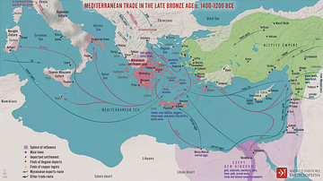
Mediterranean Trade in the Late Bronze Age c. 1400-1200 BCE
A map illustrating the late Bronze Age trade in the eastern Mediterranean seaboard as a region of increasing connectivity between the key players Pharaonic Egypt in the south, the Hittite Empire, Mesopotamia, and the Levant to the east, and...
Image
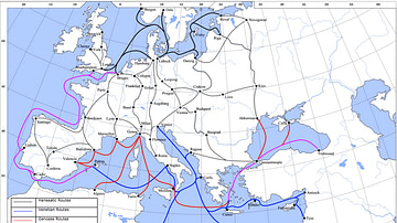
Late Medieval Land & Maritime Trade Routes
A map showing the late medieval trade routes by land and sea across Europe and Western Asia.
Image
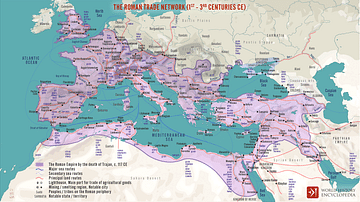
The Roman Trade Network (1st - 3rd centuries CE)
A map illustrating the principal trade routes of overseas and transregional exchange of goods across the Roman Empire between the first and third centuries. The depiction is schematic not only for the completeness of adequate historical knowledge...
Image
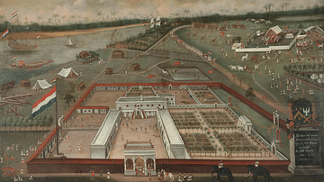
VOC Trade Lodge in Hooghly, Bengal
A 1665 painting by Hendrik van Schuylenbergh showing the Dutch East India Company (VOC) Trade Lodge in Hooghly, Bengal. (Rijksmuseum, Amsterdam)

Video
How Roman Trade with India Made the Empire Rich
This video was sponsored by Imperator: Rome. You can support our channel by buying this game via this link: https://store.steampowered.com/app/859580/Imperator_Rome/ We are continuing our new animated historical documentary series on the...
Image
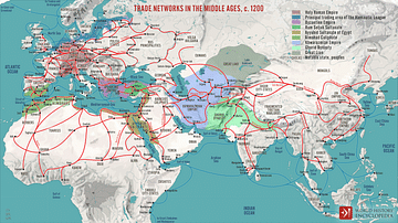
Trade Networks in the Middle Ages, c. 1200
A map illustrating the interconnectivity and extent of the global trade networks at the onset of the 13th century after the centuries of decline and isolation following the collapse of the Western Roman Empire. The conditions were beginning...
Image
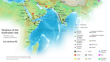
Ancient Indian Maritime Trade Routes
This map is derived from the book Periplus of the Erythraean Sea. It depicts trade routes in the ancient world, ports in the Chera territory and other parts of India and the trade routes connecting them to other parts of the world along with...
Image
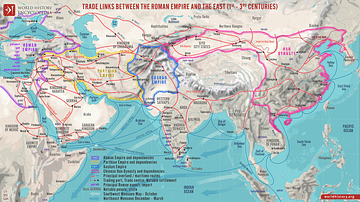
Trade Links between the Roman Empire and the East (1st - 3rd centuries)
A map illustrating the ever-growing and ever-changing trade network of maritime and overland routes connecting China, India, and the Far East with the Middle East and Europe. Even though the term "Silk Road" was not defined until the late...