
Search
Did you mean: Bes?
Search Results

Image
The Mongol Scroll, 1293 CE
The Mongol Scroll, aka the 'Illustrated Account of the Mongol Invasion of Japan.' Commissioned by Takezaki Suenaga, a samurai warrior who fought during the Mongol invasions of Japan in 1274 and 1281 CE, the painted scroll was produced in...
Image
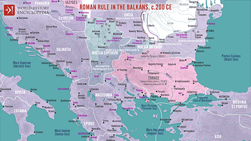
Roman Rule in the Balkans, c. 200 CE
A map illustrating Roman rule in the Balkans around 200 CE, characterized by significant administrative, military, and cultural integration into the Empire. The region was divided into several provinces (Moesia Superior, Moesia Inferior...
Image
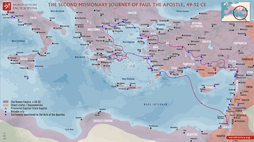
Paul the Apostle's Second Missionary Journey (c. 49-52 CE)
Paul the Apostle undertook multiple missionary journeys across the Roman Empire to spread Christianity, establish churches, and strengthen the faith of early Christians. Paul's second missionary journey, accompanied by Silas and later joined...

Image
Diaspora Synagogues (1st - 2nd centuries CE)
A map of Diaspora synagogues around the 1st - 2nd centuries CE showcasing the geographical spread of Jewish communities outside the ancient Israelite homeland. The map highlights notable synagogues of that era, illustrating the extent of...
Image
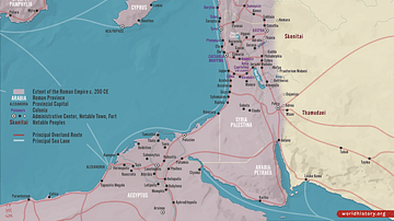
Roman Rule in the Levant, c. 200 CE
This map illustrates the Roman Levant c. 200 CE, encompassing the provinces of Syria Coele, Syria Phoenice, Judea (renamed Syria Palaestina), and Arabia Petraea. It was a culturally diverse and strategically vital region, serving as a trade...
Image
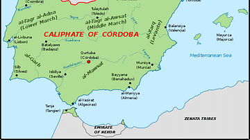
The Iberian Peninsula, c. 1000 CE
A map of the Iberian peninsula c. 1000 CE showing the divide between the Muslim Caliphate of Cordoba in the south and the Christian kingdoms in the north.
Image
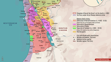
Herodian Tetrarchy in the Levant, c. 5 CE
A map illustrating the geopolitical situation in the Levant after Herod the Great's death (an ambitious ruler appointed as the King of Judea by the Roman Senate in 37 BCE). The Herodian Tetrarchy, established by Herod the Great's will, divided...
Image
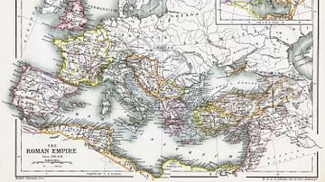
Map of the Roman Empire, 350 CE
A map of the Roman Empire, circa 350 CE, showing its Dioceses, the administrative divisions of the late Roman Empire.
The diocese was introduced by emperor Diocletian to supplant the province as administrative unit of the empire.
Image
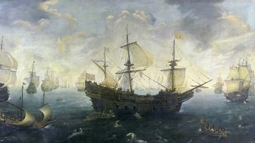
The Spanish Armada of 1588 CE By van Wieringen
A 17th century CE painting by Cornelis Claesz van Wieringen of the Spanish Armada which sailed to invade England in 1588 CE. (Rijksmuseum, Amsterdam)
Image
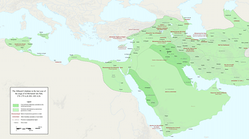
Fragmentation of the Abbasid Empire (891-892 CE)
A map showing various territories that were carved up by local rulers in the late 9th Century CE, either under the suzerainty of the Abbasid Dynasty or in rebellion against the Abbasid Empire.