Search
Did you mean: Bes?
Search Results

Image
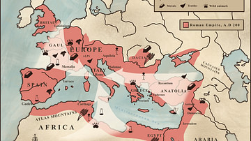
Trade in the Roman Empire Map (c. 200 CE)
This map shows the major sources of trade goods in the Roman Empire, circa 200 CE. The map shows the sources of the following trade goods: grain, olive oil, slaves, wine, metals, textiles and wild animals.

Image
Map of the Holy Roman Empire, 972-1032 CE
Map of the Holy Roman Empire depicting its boundaries under the rule of Otto I in 972 CE and Conrad II in 1032 CE.

Image
Roman Empire under Constantine, 324-337 CE
This map illustrates Constantine I's (also known as Constantine the Great, c. 272-337 CE) rise to power, beginning with his proclamation as emperor by his troops in 306 CE and solidified through key military victories, including the Battle...

Image
Map of Roman North Africa (146 BCE - 395 CE)
This map illustrates the scope and administrative organization of the Roman provinces in North Africa, from the initial conquest in 146 BCE to their full integration into the empire. Following the destruction of Carthage at the end of the...

Image
The Roman Tetrarchy Under Diocletian, 293–305 CE - An Empire Rebuilt — Stability Through Division, Succession by Design
This map illustrates the Roman Tetrarchy, a four-part imperial system established by Emperor Diocletian (reigned 284–305 CE) in 293 CE to stabilize and defend the sprawling Roman Empire. It aimed to address political instability, streamline...

Image
Division of the Byzantine Empire, 1204 CE.
This map illustrates the rise of the Latin Empire (Imperium Romaniae), a Crusader state founded by Western European forces after the Fourth Crusade's sack of Constantinople in 1204. It replaced the Byzantine Empire (Eastern Roman Empire...

Image
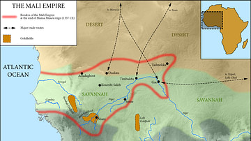
Map of the Mali Empire, c. 1337 CE
A map of the Mali Empire (1240-1645 CE) at its peak c. 1337 CE after the reign of Mansa Musa (1312-1337 CE).

Image
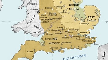
England Around 910 CE
Map showing England around 910 CE, showing among others the Viking territories under the Danelaw as well as the English kingdoms of Mercia (at this point in time ruled by Aethelred, Lord of the Mercians (r. 881-911 CE) and Wessex.

Image
11th century CE Kievan Rus Territories
Map of Kievan Rus territories during the feudal split, after the death of Prince Yaroslav the Wise in 1054 CE.

Image
Map of Francis Drake's Circumnavigation, 1577-80 CE
A map showing the circumnavigation of the globe by Francis Drake (c. 1540-1596 CE). The voyage was undertaken in 1577-80 CE in the Golden Hind.