
Search
Remove Ads
Advertisement
Search Results

Image
Totalitarian Regimes in Europe in 1939
This map illustrates the geopolitical situation in Europe in the lead-up to the Second World War (1939-45) as authoritarianism and totalitarianism were on the rise across the continent, fueled by political instability, economic crises, and...

Image
The Formidable Women Who Shaped Medieval Europe
Cover of The Formidable Women Who Shaped Medieval Europe: Power and Patronage at the Burgundian Court by Susan Abernethy. This is a collection of 31 women who were related by blood, marriage, and politics to the Valois Dukes of Burgundy...
Image
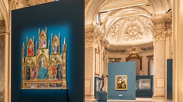
Pre-Raphaelites: Modern Renaissance in Forlì
Pre-Raphaelites: Modern Renaissance, exhibition installation view, photo by Emanuele Rambaldi.
San Domenico Museum, Forlì, Italy.
Image
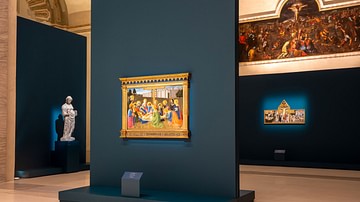
Pre-Raphaelites: Modern Renaissance Exhibition
Pre-Raphaelites: Modern Renaissance, exhibition installation view, photo by Emanuele Rambaldi.
San Domenico Museum, Forlì, Italy.

Article
The Spice Trade & the Age of Exploration
One of the major motivating factors in the European Age of Exploration was the search for direct access to the highly lucrative Eastern spice trade. In the 15th century, spices came to Europe via the Middle East land and sea routes, and spices...
Image
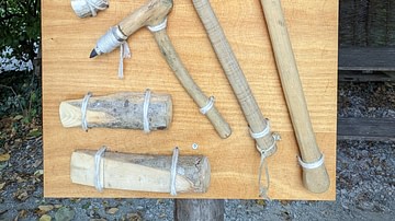
Stone Age Tools (Modern Recreations)
A collection of modern recreations of Stone Age tools. The picture above shows (from top right to bottom left): - A hatchet with a wing spar, used for felling trees - A straight hatchet for shortening smaller pieces of wood (with a piece...
Image
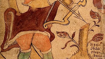
Modern Representation of Ullr
Representation of the Germanic god Ullr (Ull), a figure in Norse mythology, with a bow and skis. From an 18th Century Icelandic manuscript. Collection of the Árni Magnússon Institute for Icelandic Studies.
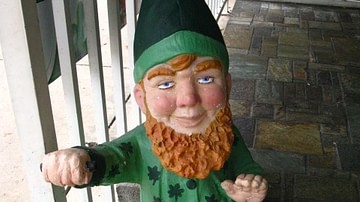
Image
Modern Leprechaun Figure
A modern figure of a leprechaun, the diminutive fairy-goblin of Irish folklore. The youthfulness, hat and red beard are not typical of the medieval character.

Image
Modern-day Statue of Melusine, Luxembourg
A modern statue of Melusine by Serge Ecker in Luxembourg.

Image
Oldest Mural in Europe
This photo shows a reconstruction of the "Cult Wall" of Ludwigshafen, the oldest mural in Europe. The original painting was created around 3860 BCE, depicting hunting trophies of aurochs and bison, fine textiles, as well as a human torso...