Search
Search Results

Image
Map of the Old Assyrian Empire - Between Cities & Kingdoms -The Foundations of Imperial Power
This map illustrates the political landscape of the Ancient Near East around c. 1700 BCE, during the Old Assyrian period and shortly before the rise of the Babylonian Empire under Hammurabi (reigned c. 1792–1750 BCE). It highlights key regional...

Image
Map of the Byzantine Empire, c.520 - 1204
This map illustrates the shifting frontiers of the Byzantine Empire from the accession of Justinian I (reign circa 527 - 565) to the Fourth Crusade's sack of Constantinople in 1204, showing how the Greek-speaking eastern Roman state acted...

Image
Map of the Fall of the Western Roman Empire, c. 480 CE
This map illustrates the gradual disintegration of the Western Roman Empire during the Migration Period (circa 400-800 CE), when waves of migrating and invading peoples reshaped Europe. After the death of Theodosius I (reign 379-395 CE...

Image
Byzantine Empire c. 626 CE
A map of the Byzantine empire c. 626 CE.

Image
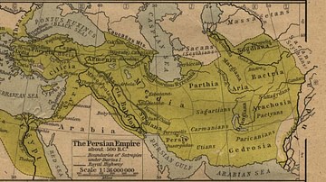
The Persian Empire
The Persian Empire about 500 BC.

Image
Map of the Aztec Empire, c. 1427–1521 - The Rise and Fall of Mesoamerica’s Warrior Kings
This map illustrates the origins and territorial expansion of the Aztec Empire in Mesoamerica between the 14th and 16th centuries. Emerging from a network of Nahua-speaking city-states in central and southern Mexico, the empire rose to dominate...

Image
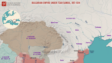
Bulgarian Empire under Tsar Samuil, 997 - 1014
A map illustrating the reign of Samuil (Bulgarian: Самуил,) Tsar of the First Bulgarian Empire from 997 to 1014. His rule faced significant challenges, particularly the expansionist policies of the Byzantine Empire under Emperor Basil II...

Image
The Sassanid Empire c. 620 CE
A map illustrating the rise and expansion of the Sassanid Empire (also known as Erānshahr, "the Domain of the Iranians/Aryans" or Neo-Persian Empire.) Named after the House of Sasan, it was the longest-lived Persian imperial dynasty, enduring...

Image
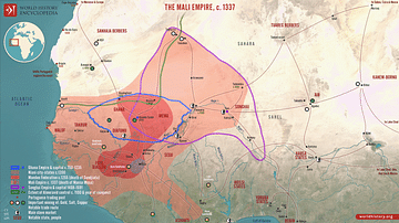
Map of the Mali Empire
A map illustrating the rise and extent of the Mali Empire (c. 1235 - 1672) as it reached its height in the 13th century as one of the most powerful and wealthy states in West Africa. Spanning a vast territory that included modern-day Mali...

Image
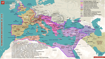
Roman Empire under Constantine, 324-337 CE
This map illustrates Constantine I's (also known as Constantine the Great, c. 272-337 CE) rise to power, beginning with his proclamation as emperor by his troops in 306 CE and solidified through key military victories, including the Battle...