
Search
Search Results

Image
Gupta Dynasty India, 320 - c. 550 CE
A map illustrating the rise to power and expansion of the Gupta dynasty in India. Once rulers of the Magadha (now Bihar) kingdom, between the early 300s and mid-500s, they held an empire in northern and parts of central and western India...
Image
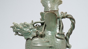
Celadon Fish-Dragon Ewer, Goryeo Dynasty
A celadon fish-dragon ewer. 12th century CE, Goryeo Dynasty, Korea. (National Museum of Korea, Soul, South Korea)
Image
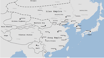
Liao Dynasty Map
A map indicating the territory controlled by the Liao dynasty (Khitans), 907-1125 CE.
Image
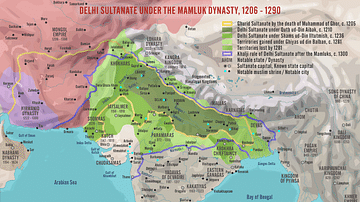
Delhi Sultanate under the Mamluk Dynasty, 1206-1290
A map illustrating the rise and evolution of the Sultanate of Delhi during the times of its first ruling dynasty – the Mamluks (also known as the Slave or Ghulam Dynasty), an influential military class of slave soldiers between 1206 and 1290...
Image
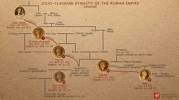
Julio-Claudian Dynasty of the Roman Empire
A depiction of the evolution of the first imperial dynasty of ancient Rome, the Julio-Claudians that began with Augustus (Julius Caesar's adopted son) and included the reigns of Tiberius, Caligula, Claudius, and Nero. During their time, Rome...

Image
Tang Dynasty Provinces c. 742 CE
The provinces of the Tang Dynasty c. 742 CE. The Tang Dynasty (618-907 CE) is regularly cited as the greatest imperial dynasty in ancient Chinese history. It was a golden age of reform and cultural advancement, which lay the groundwork for...
Image
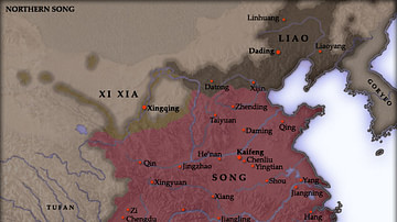
Northern Song Dynasty Map
A map indicating the territory of the Northern Song Dynasty of China, 960-1125 CE.

Image
Map of the Ming Dynasty Territory
A map indicating the territory controlled by the Ming Dynasty (1368 to 1644 CE) in the late 16th century CE.
Image
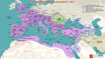
The Roman Empire during the Flavian Dynasty, 69 - 96 CE
A map illustrating the territorial extent and political boundaries of the Roman Empire during the Flavian Dynasty, around 96 CE. Although a short-lived sequence of reigns from Vespasian (69 - 79 CE) through Titus (79 – 81 CE), until Domitian...
Image
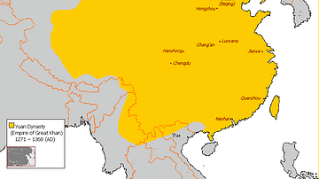
Map of Yuan Dynasty China
A map indicating the territory of the Mongol Yuan dynasty of China (1271-1368 CE).