
Search
Did you mean: Trajan?
Search Results
Lesson Pack
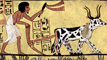
Geography, Economy, & Trade in Ancient Egypt
We have prepared three lesson plans including classroom activities, assignments, homework, and keys as well as: Multiple choice quiz questions in an excel format. Glossary of keywords and concepts in an excel format. Open questions...
Lesson Pack
Roman Economy & Trade
We have prepared three lesson plans including classroom activities, assignments, homework, and keys as well as: Glossary of keywords and concepts in an excel format Open questions adaptable for debates, presentations, and essays Recommended...
Image
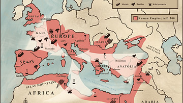
Trade in the Roman Empire Map (c. 200 CE)
This map shows the major sources of trade goods in the Roman Empire, circa 200 CE. The map shows the sources of the following trade goods: grain, olive oil, slaves, wine, metals, textiles and wild animals.
Image
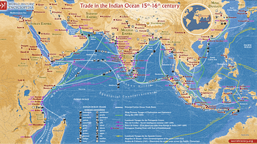
Trade in the Indian Ocean 15th-16th century
This map illustrates the Indian Ocean trade (15th–16th centuries), a vast maritime network linking East Africa, the Middle East, South Asia, and Southeast Asia, facilitating the exchange of spices, textiles, metals, timber, and luxury goods...
Image
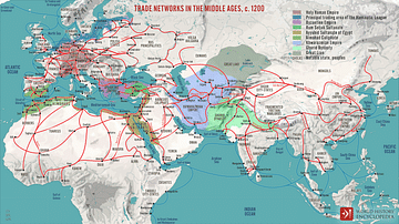
Trade Networks in the Middle Ages, c. 1200
A map illustrating the interconnectivity and extent of the global trade networks at the onset of the 13th century after the centuries of decline and isolation following the collapse of the Western Roman Empire. The conditions were beginning...
Image
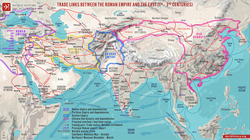
Trade Links between the Roman Empire and the East (1st - 3rd centuries)
A map illustrating the ever-growing and ever-changing trade network of maritime and overland routes connecting China, India, and the Far East with the Middle East and Europe. Even though the term "Silk Road" was not defined until the late...
Image
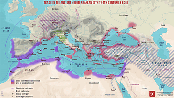
Trade Routes in the Ancient Mediterranean
A map illustrating the boundaries, spheres of influence, and the flow of trade around the Mediterranean Sea between the 7th and 4th centuries BCE.
Image
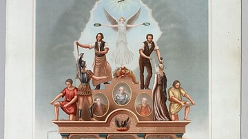
Trade Union Scroll for the Amalgamated Society of Engineers
A trade union scroll for the Amalgamated Society of Engineers, created in January 1851. The scroll shows illustrations of important engineers and inventions during the Industrial Revolution. (Science Museum, London)
Collection
Ancient China: Geography, Economy & Trade
Ancient China was often connected to the rest of the world through trade, not only along the famous Silk Road but also via merchant ships that sailed the Indian Ocean, connecting East Asia to the Middle East, Europe, and Africa. Silk, paper...
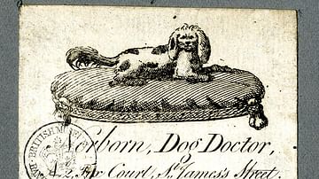
Image
Trade Card of a Veterinary Surgeon
Trade card of Norborn, veterinary surgeon.
c. 1760-1818 CE.