Search
Search Results

Definition
Kingdom of Kanem
The Kingdom of Kanem (aka Kanim) was an ancient African state located in modern-day Chad, which flourished from the 9th to 14th century CE. With its heartland in the centre of the African continent on the eastern shores of Lake Chad, the...

Image
Map of the East India Company Trade, c.1800
The English East India Company (EIC) was established by Royal Charter on 31 December 1600 under Queen Elizabeth I (reign 1558–1603), granting it a monopoly on English trade east of the Cape of Good Hope. Initially conceived as a commercial...

Collection
Trade & Commerce in Ancient Greece
The ancient Mediterranean was a busy place with trading ships sailing in all directions to connect cities and cultures. The Greeks were so keen on the rewards of trade and commerce that they colonized large parts of the coastal Mediterranean...

Definition
Portuguese Malacca
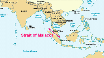
The Portuguese colonised Malacca (modern Melaka) on the southwest coast of the Malay peninsula from 1511 and kept it until 1641 when the Dutch took over. The port controlled the Malay Straits which lead from the Indian Ocean (the Andaman...

Definition
Kingdom of Benin
The Kingdom of Benin, located in the southern forests of West Africa (modern Nigeria) and formed by the Edo people, flourished from the 13th to 19th century CE. The capital, also called Benin, was the hub of a trade network exclusively controlled...

Image
Map of the Trade Routes in the Ancient Mediterranean
This map illustrates the dynamic trade networks of the ancient Mediterranean between the 7th and 4th centuries BCE, highlighting the spheres of influence of the Phoenicians and Greeks as they established settlements, trading posts, and seafaring...

Definition
Wolof Empire
The Wolof (aka Jolof or Djolof) Empire was a state on the coast of West Africa, located between the Senegal and Gambia rivers, which thrived from the mid-14th to mid-16th century CE. The empire prospered on trade thanks to the two rivers...

Definition
John Hawkins
Sir John Hawkins (1532-1595 CE) was an Elizabethan mariner, merchant and naval administrator who has the inglorious (if not wholly accurate) record of being England's first slave trader. In the 1560s CE Hawkins trafficked slaves from West...

Image
Map of the Hanseatic League Trade Network, c. 1400
The Hanseatic League (c. 13th–17th centuries) was a powerful network of merchant guilds and cities that dominated trade across northern Europe for centuries. Emerging in the late Middle Ages, the League united towns from Lübeck, Hamburg...

Definition
Portuguese Goa
Goa, located on the west coast of India, was a Portuguese colony from 1510 to 1961. The small coastal area was conquered by Afonso de Albuquerque (c. 1453-1515) and became an important trade hub for the Eastern spice trade. Goa was the capital...