
Search
Search Results
Article
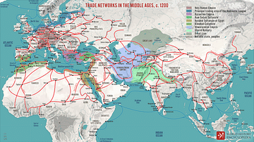
Global Trade in the 13th Century
In the 13th century, astonishing quantities of spices and silk passed from the Far East to Europe. Exact amounts are not known, but spice popularity in both cuisine and medicine reached its historical peak during the Middle Ages in Europe...
Image
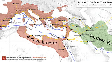
Map of Roman & Parthian Trade Routes
This map shows the Roman-Parthian trade route system, circa between the 1st and the 3rd centuries CE. During this period, the Roman Empire and the Parthian Empire were the two superpowers of the region and the Roman-Parthian trade system...
Image
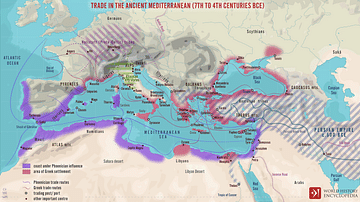
Trade Routes in the Ancient Mediterranean
A map illustrating the boundaries, spheres of influence, and the flow of trade around the Mediterranean Sea between the 7th and 4th centuries BCE.
Image
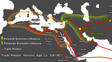
Hellenistic Trade Routes, 300 BCE
Alexander the Great died in Babylon on the 13th of June, 323 BCE. His Macedonian-Greek empire broke apart, but Alexander’s heritage was felt throughout the ancient Mediterranean world for centuries. Three Hellenic empires emerged from the...
Image
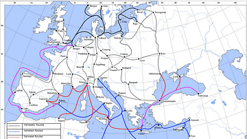
Late Medieval Land & Maritime Trade Routes
A map showing the late medieval trade routes by land and sea across Europe and Western Asia.

Definition
Timbuktu - West Africa's Great Trading Centre
Timbuktu (Timbuctoo) is a city in Mali, West Africa which was an important trade centre of the Mali Empire which flourished between the 13th and 15th centuries. The city, founded c. 1100, gained wealth from access to and control of the trade...
Image
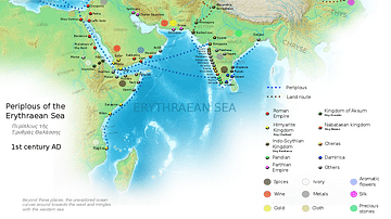
Ancient Indian Maritime Trade Routes
This map is derived from the book Periplus of the Erythraean Sea. It depicts trade routes in the ancient world, ports in the Chera territory and other parts of India and the trade routes connecting them to other parts of the world along with...
Image
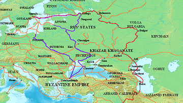
Varangian Trade Routes
Map showing Varangian trade routes.
Red: Volga trade route
Purple: trade route from the Varangians to the Greeks
Orange: Other trade routes of the 8th-11th centuries
Image
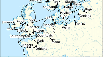
Viking Age Trade Routes in North-West Europe
Map showing some of the Viking Age (c. 790-1100 CE) trade routes that existed in North-West Europe during this time. Among the places depicted are such major trading centres are Hededy, Ribe, Birka and Kaupang from Viking Scandinavia; York...
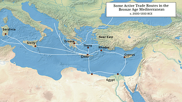
Image
Some Active Trade Routes in the Bronze Age Mediterranean
A map detailing some of the active maritime trade routes in the Aegean during the Middle and Late Bronze Age.